Summary

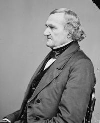
Portrait of John Catron John Catron Magwire v. Tyler — Opinion of the Court

In 1847 the matter as regarded these surveys was reported by the Surveyor General to the General Land Office, where it was held that Brazeau was entitled to his four arpents square in the southeasterly part of Soulard's Spanish survey of 1799, which embraced both Labeaume's and Brazeau's tracts. This decision was overruled by Secretary Steuart in 1851, under whose order a survey was made for Brazeau outside of Labeaume's survey, as made by Brown.
Source: Wikisource

Portrait of John Catron John Catron Magwire v. Tyler — Opinion of the Court

When this survey was presented to the recorder of land titles to obtain a patent certificate, he refused to issue one, because both tracts were included in one survey; whereas, the recorder held that the confirmation certificates required separate surveys. Thus the matter stood till 1833, when Brown made another survey of Labeaume's tract, maintaining the ditch as the southern boundary, and throwing off on the west a surplus to reduce the tract to the quantity confirmed to Labeaume.
Source: Wikisource

Portrait of John Catron John Catron Magwire v. Tyler — Opinion of the Court

In 1798, Brazeau sold and conveyed to Labeaume part of his concession. The deed includes four arpents, 'to be taken from the foot of the hill or mound commonly called the Grange de Terre, by twenty arpents in depth, bounded by the Rocky branch on the extremity opposite the said mound; reserving to myself (says Brazeau's deed) four arpents of land, to be taken at the foot of said mound, in the southern part of the aforesaid tract
Source: Wikisource

Get perspective with Kwize: daily news enlightened by great literature