Wabash River

Definition and stakes

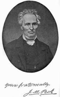
Portrait of John Mason Peck John Mason Peck,  A New Guide for Emigrants to the West

“ The east and west forks of White river, and their tributaries, water the interior counties for 100 miles in extent. They are [Pg 227] both navigable streams for flat boats during the spring and autumn floods. The Wabash river has several heads, which interlock with the waters of the St. Joseph and St. Mary's, which form the Maumee of lake Erie. It runs a south-westwardly course across the State to Warren county,—thence southwardly to Vigo county, where it becomes the boundary between Indiana and Illinois, along which it meanders to the Ohio, which it enters 12 miles above Shawneetown. ”

Source: Gutenberg

Elmore Barce,  The Land of the Miamis

“ To the north lies the long range of the Indian Hills, crowned with forest trees, and scarped with many a sharp ravine. At the southern edge of these hills flows the Wabash, winding in and out with graceful curves, and marked in its courses by a narrow fringe of woodland. To the east lies Wea creek, jutting out into the plain with a sharp turn, and then gliding on again to the river. Within this enclosure of wood and stream lie the meadows of the Ouiatenons, dotted here and there with pleasant groves, and filled with the aroma of countless blossoms. ”
Source: Gutenberg

Sir Charles Prestwood Lucas,  A history of Canada, 1763-1812 (1909)

“ The Maumee river flows into the south-western end of Lake Erie, and on it, at a point where there was a portage to the Wabash river, was constructed Fort Miami, on or near the site of the later American Fort Wayne. On the Wabash, which joins the Ohio not very far above the confluence of the latter river with the Mississippi, were two French posts, Fort Ouatanon and, lower down its course, Fort Vincennes. ”
Source: Gutenberg

Get perspective with Kwize: daily news enlightened by great literature