“ The appearance of the Jumna, even in the dry season, strikes one as very imposing, with its enormous span from shore to shore, shut in by high, shelving, sandy banks, its then placid waters a clear bright blue. What must be the effect in the freshes, when its surging waters rush resistlessly past, and its banks are hidden by a suddenly formed expanse of water more resembling sea than river? ”
Jumna River
Definition and stakes
The theme of “Jumna River” has been addressed by authors such as W. W. W. Humbley, George Francis White, Hermann Hesse, Charles Sturt and Sir Alexander Burnes. It is often associated with terms like Ganges, India, lake, canal and Jamuna.
Quotes about “Jumna River”
 Burton Egbert Stevenson,
The Home Book of Verse — Volume 3
“ THE HILLS Mussoorie and Chakrata Hill The Jumna flows between And from Chakrata's hills afar Mussoorie's vale is seen. The mountains sing together In cloud or sunny weather, The Jumna, through their tether, Foams white or plunges green. The mountains stand and laugh at Time, They pillar up the Earth, They watch the ages pass, they bring New centuries to birth. They feel the daybreak shiver, They see Time passing ever, As flows the Jumna River As breaks the white sea-surf. They drink the sun in a golden cup And in blue mist the rain ”
“ JUMNA, n.p. The name of a famous river in India which runs by Delhi and Agra. Skt. Yamunā, Hind. Jamunā and Jamnā, the Διαμούνα of Ptolemy, the Ἰωβαρής of Arrian, the Jomanes of Pliny. The spelling of Ptolemy almost exactly expresses the modern Hind. form Jamunā. The name Jamunā is also applied to what was in the 18th century, an unimportant branch of the Brahmaputra R. which connected it with the Ganges, but which has now for many years been the main channel of the former great river. ”
1911 Encyclopædia Britannica (1911)
“ The south-western region has the same natural advantages, but possesses no great irrigation system, and is consequently less fruitful than the opposite slopes. Near the banks of the Jumna, the plain descends into the river valley by a series of wild ravines and terraces, inhabited only by a scattered race of hereditary herdsmen. Beyond the Jumna again a strip of British territory extends along the tangled gorges of the Chambal and the Kuari Nadi, far into the borders of the Gwalior state. ”
1911 Encyclopædia Britannica, Volume 17… (1911)
“ On the south-western boundary the Jumna flows in a deep alluvial bed, sometimes sweeping close to the high banks which overhang its valley, and elsewhere leaving room for a narrow strip of fertile soil between the river and the upland plain. ”
 Oliver Optic,
Across India; Or, Live Boys in the Far East
“ Delhi is on the Jumna River, which you saw in the early morning. This stream has its entire course in Hindustan, and is the principal tributary of the Ganges. Both of these rivers are sacred with the natives. The Jumna rises in the Himalayas, at a height of nearly eleven thousand feet, and of course it is a mountain torrent at its upper waters. After a run of eight hundred and sixty miles, it falls into the Ganges about three miles below Allahabad. ”
1911 Encyclopædia Britannica (1911)
“ The weir across the Jumna was the first attempted in Upper India upon a foundation of fine sand; it is about 800 yds. long, and rises 7 ft. above the summer level of the river. From Okla the canal follows the high land between the Khari-nadi and the Jumna, and finally joins the Banganga river about 20 m. ”
Fanny Parkes Parlby, Wanderings of a pilgrim in search of the picturesque… (1850)
“ The pinnace at anchor on the Jumna below the bank rolls and rocks; the river rises in waves, like a little sea. Some of her iron bolts have been forced out by the pressure of the cables, and the sarang says, she can scarcely hold to her moorings. I am watching her unsteady masts, expecting the next gust will tear her from the bank, and send her off into the rushing and impetuous current. It is well it is not night, or she would be wrecked to a certainty. I have not much faith in her weathering such a tūfān at all, exposed as she is to the power of the stream and the force of the tempest. ”
W. W. W. Humbley, Journal of a Cavalry Officer; Including the Memorable Sikh Campaign of 1845-1846
“ The central situation of the city, its position on the right bank of the Ganges, the circumstance of its superior sacredness, and above all, the fact that the Jumna is the third river in India, which no one, who will compare [Pg 328] the relative claims of the rivers, can deny; all these together yield more than presumptive proof in its favour. We may fairly conclude then, that the ancient Palibothra is at the junction of the Ganges and the Jumna, and that there appears no just ground for supposing that any other position on the right or left bank of the Ganges can be assigned as its site. ”
George Francis White, Views in India, chiefly among the Himalaya Mountains (1838)
“ There are several hot springs to be found along the course of the Jumna, for which, according to general belief, the traveller is indebted to an exceedingly pious person, favoured by the gods with the gift of causing hot water to flow whenever he found that of the river too cold for the comfortable performance of his ablutions. ”
Earl of James Bruce Elgin, Letters and Journals of James, Eighth Earl of Elgin
“ The road, thickly lined with native troops, crossed the Jumna by a bridge of boats, and wound along the river's bank beneath those lofty sandstone walls; then, mounting a steep hill and leaving the main entry into Agra Fort upon the right, the Taj remaining to the left, it led, through miles of garden ground, thickly studded with suburban villas, to the Viceroy's camp, that occupied the centre of an extensive plain, where tents were pitched for the accommodation of the Government of India, and an escort of ten thousand men. ”
Jules Joubert, Shavings & Scrapes from many parts
“ A single one of its many tributaries—the Jumna—has an independent existence of 860 miles, with a catchment basin of 118,000 square miles, and starts from an elevation at its source of 10,849 feet above sea-level.As a factor in the commercial welfare of India the Ganges plays an important part. Until the opening of the railways its waters formed the almost sole channel of traffic between Upper India and the sea-board. The products not only of the river plains, but even those of the central provinces, were all brought by this route into Calcutta. ”
W. W. W. Humbley, Journal of a Cavalry Officer; Including the Memorable Sikh Campaign of 1845-1846
“ The River Jumna takes its name from Yumna, which in Sanscrit means, meeting, or confluence. Some of the religious ceremonies enjoined upon the Hindoo pilgrims must be performed in a vast subterranean cave, which is situated in the middle of the Fort—it is supported by pillars, and is believed by the vulgar to extend under ground as far as Benares, a distance of fifty-three miles, and to be infested by snakes and poisonous reptiles—granting the cave really to extend thus far, who could possibly live to go through to its termination! ”
W. W. W. Humbley, Journal of a Cavalry Officer; Including the Memorable Sikh Campaign of 1845-1846
“ The next attempt was to steam up the Jumna, but meeting with a shoal at Kulna, the steamer could proceed no further. The rocks which formerly existed in this river, were blasted by the late Lieutenant-Colonel Joseph Taylor, of the Engineers.The question naturally arises, why the same remedy could not be applied as at Gottenburg, in Sweden, where rapids have been passed by making a canal outside; and why, in India, canals are never resorted to for out-flanking an impediment in a river? This, however, is an enquiry to which no satisfactory reply has ever yet been given. ”
Nelson W. Green, Popular Science Monthly (1880)
“ The ordinary observer will recall the common fact that the highest land is universally best supplied with flowing springs, and that these overflows can not be accounted for on the supposition of the fall of waters from higher grounds, since such higher grounds do not adequately exist. "The cataract issuing from the Himalayas, or as it is sometimes called Roodroo, is the source of the river Jumna—a rapid and large river; and in fact, many of the largest rivers of the world proceed immediately from mountains and lakes that are formed from cataracts." ”
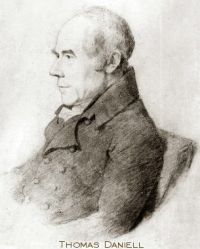 Thomas Daniell,
Oriental Scenery
(1816)
“ Part of this city is very ancient, and is much frequented by the religious Hindoos, (it being the reported birth-place of Krishna,) for the purpose of bathing in the river Jumna, which is held in high estimation. The Jumna unites with the Ganges at Allahabad. ”
R. V. Russell, The Tribes and Castes of the Central Provinces of India…
“ On the cheeks and temples they make rosette-like marks by bunching up the five fingers, dipping them in a solution of sandalwood and then applying them to the face.1 They regard the Jumna as a sacred river and its water as holy, no doubt because Mathura is on its banks, but pay no reverence to the Ganges. Their priests observe celibacy, but do not practise asceticism, and all the Dhāmis are strict vegetarians. ”
Various, Encyclopaedia Britannica, 11th Edition…
“ To the S.E. the Vindhya chain of hills takes its origin in a low range not exceeding 500 ft. in height, and forming a natural boundary of the district in that direction. The principal river of the district is the Jumna, which flows from north-west to south-east, along the N.E. boundary of the district, for 125 m. In 1901 the population was 631,058, showing a decrease of 11% in the decade, due to the effects of famine. The black soil of the district yields crops of which the principal are millet, other food-grains, pulse, rice, cotton and oil-seeds. ”
Various, Encyclopaedia Britannica, 11th Edition…
“ The catchment area of the river is 118,000 sq. m.; its flood discharge at Allahabad is estimated at 1,333,000 cub. ft. per second. The Jumna is crossed by railway bridges at Delhi, Muttra, Agra and Allahabad, while bridges of boats are stationed at many places.JUMPING,1 a branch of athletics which has been cultivated from the earliest times (see Athletic Sports) . Leaping competitions formed a part of the pentathlon, or quintuple games, of the Olympian festivals, and Greek chronicles record that the athlete Phayllus jumped a distance of 55 Olympian, or more than 30 English, feet. ”
1911 Encyclopædia Britannica, Volume 15… (1911)
“ From Dankaur it resumes its southerly course for 100 m. to Mahaban near Muttra, where it turns E. for nearly 200 m., passing the towns of Agra, Ferozabad and Etawah, receiving on its left bank the Karwan-nadi, and on its right the Banganga (Utanghan) . From Etawah it flows 140 m. S.E. to Hamirpur, being joined by the Sengar on its north bank, and on the south by the great river Chambal from the west, and by the Sind. ”
George Francis White, Views in India, chiefly among the Himalaya Mountains (1838)
“ As we approached Jumnootree, which is not accessible until the month of May, we found the river gliding under arches of ice, through which it had worn its passage, and at length, these masses becoming too strongly frozen to yield and fall into the current, the stream itself could be traced no longer, and, if not at its actual source, we stood at the first stage of its youthful existence. It is quite impossible to prevent a feeling of exultation from springing up in the mind, at the completion of a pilgrimage to a place so deservedly celebrated ”
A. Hamilton, Afghanistan (1906)
“ This river, rising in the Taimani country, flows past Farah and Lash into the Hamun at its north-west angle, after a southerly course 200 miles in length. Its volume varies with the seasons. The water is usually clear and not quite drinkable for, after the main stream has been exhausted by the fields, the pools which remain in its deeper parts quickly become stagnant. In the spring it is a wide, deep river, always with sufficient water for irrigation in its course: even when nearly dry water is to be found by digging a foot into the river-bed. ”
J. McF. Gaston, Hunting a home in Brazil (1867)
“ A change, however, in the land, seems to commence near this place, and it assumes here very much the aspect of red clay, but in some parts the sandy soil predominating, and all lying very irregular, except immediately upon the streams.I was impressed with the adaptation of the Jundiahi river, a small stream which runs near our inn, for the location of machinery of limited water-power; and when the railroad reaches this place a good mill or cotton ginning establishment would be likely to prove very advantageous on this river. ”
George Francis White, Views in India, chiefly among the Himalaya Mountains (1838)
“ At a short distance from Kursalee, the celebrated hot spring occurs which issues from the bed of a torrent that joins the Jumna at a place called Banass. This torrent rushes from the cleft of one of the mountains which hem in a small valley, or rather dell, and rushes down in one unbroken volume from a height of at least eighty feet: the hot spring which issues from the base of the opposite mountain, and mingles its waters with its colder but more impetuous neighbour, is of a scalding description, and will not admit of the immersion of the hand or foot for a single moment. ”
George Francis White, Views in India, chiefly among the Himalaya Mountains (1838)
“ Crossing the snowy bed whence the water emerges at Jumnootree, is a work of some difficulty, and when accomplished we find that the infant river is divided into three streams, each forming a separate waterfall, and flowing over steep green hills. The lower of these are surmountable, but with great difficulty and some danger, as the stones are loose, and slip from under the feet: in process of time, however, we may look forward to such an improvement in the roads of these hills as will allow the traveller to reach the utmost extent which human means can render possible. ”
William Charles Benett, Gazetteer of the Province of Oudh Vol-2 -- H. to M. (1877)
“ There are no mountains. Drainage.—The drainage of the country is carried on by the Gumti and Sai rivers, which in their turn receive small tributary streams. The chief of these is the Bạita, a small perennial stream, which, rising in the Hardoi district, passes through the Malihabad pargana in a south-easterly direction, and falls into the Gumti at a point on its right bank near Kánkrábad. "The Loni, another stream having its source in the Mohanlalganj pargana, passes through it, and joins the river near Salempur on its right bank. ”
Mungo Park, Life and Travels of Mungo Park
“ The tract of land which the two streams encircle is called Jinbala, and is inhabited by Negroes; and the whole distance, by land, from Jenne to Tombuctoo, is twelve days journey.From Kabra, at the distance of eleven days' journey, down the stream, the river passes to the southward of Houssa, which is two days journey distant from the river. Of the further progress of this great river and its final exit, all the natives with whom I conversed seemed to be entirely ignorant. Their commercial pursuits seldom induce them to travel further than the cities of Tombuctoo and Houssa ”
Various, Encyclopaedia Britannica, 11th Edition…
“ The Western Jumna canal crosses the district from east to west, irrigating many villages. The soil is in places hard and clayey, and difficult to till; but when sufficiently irrigated it is highly productive. Old mosques and other buildings exist in parts of the district. ”
1911 Encyclopædia Britannica (1911)
“ It is situated in the midst of the level tableland between the Jumna and the Sutlej, forming one unbroken plain of hard clay copiously interspersed with light yellow sand, and covered in its wild state by a jungle of scrubby brushwood. The only natural reservoir for its drainage is the Najafgarh jhil, a marshy lake lying within the boundaries of Delhi. ”
E. S. Bellasis, River and Canal Engineering, the characteristics of open flowing streams…
“ In the Punjab the growth of all kinds of jungle is encouraged. It binds the soil together and protects it from the wash of waves and from winds which blow away sand and dust, and so wear the embankment slowly away.In embanking a long reach of a river it is convenient to begin from the upstream end, because otherwise floods may get behind the finished part of the embankment and, becoming impounded in a “pocket” formed by the embankment and high land, rise to an abnormal height and, unless gaps in the embankment have been left or are subsequently made, cause breaches. ”
Walter Harris, Tafilet (1895)
“ The stream is not a very large one, but clear, fresh, cold water flows from the snows of the western slopes of Jibel Unila throughout the entire year. Although slightly brackish the water is drinkable to cattle, but the inhabitants rely for their supply upon the many streams and springs that form its tributaries. The river flows along the Teluet valley from east to west, and at the south-west corner of the plain passes out through a gorge to flow into the Idermi, which, eventually joining the Wad Dads, forms the Wad Draa, the largest and most important [112] river of trans-Atlas Morocco. ”
Related terms
Authors who wrote about “Jumna River”
W. W. W. HumbleyGeorge Francis White Hermann Hesse
 Charles SturtSir Alexander Burnes
 Thomas Hungerford HoldichFanny Parkes ParlbyVariousMungo ParkWilliam Charles BenettA. HamiltonE. S. BellasisWalter Harris
 James Bruce
 Joseph Conrad
 Rabindranath Tagore
 Mark Twain
 Lord Dunsany
 John Wesley Powell
 Jerome K. Jerome
Hermann HesseCharles SturtSir Alexander BurnesThomas Hungerford HoldichFanny Parkes ParlbyVariousMungo ParkWilliam Charles BenettA. HamiltonE. S. BellasisWalter HarrisJames BruceJoseph ConradRabindranath TagoreMark TwainLord DunsanyJohn Wesley PowellJerome K. Jerome