“ The Kennebec also rises in the highlands, near the sources of the Androscoggin, and flows nearly south to the sea; falls and rapids render the navigation difficult above the tide at Augusta, from which place it is navigable for vessels of one hundred tons, and from Hallowell and Gardiner for ships to the sea. The country watered by the Kennebec generally consists of excellent land; it is one of the best grazing districts in New England; and there are upon the banks of the river a number of flourishing and handsome towns. ”
Kennebec River
Definition and stakes
The Kennebec River, a 170-mile waterway in Maine, flows from Moosehead Lake through towns such as Augusta and Bath before reaching the Gulf of Maine. Its ecosystem, influenced by tides and hydroelectric structures, sustains species like the Atlantic Sturgeon, while its past is intertwined with Abenaki communities, colonial shipbuilding, and disputes over land.
Authors like Joel Cook emphasized its untamed wilderness, Archer Butler Hulbert examined its significance in Indigenous pathways, and Samuel de Champlain recorded its early European discovery. The river’s legacy combines natural magnificence with human achievement, reflecting both ecological endurance and historical evolution.
Quotes about “Kennebec River”
Portal:United States Congress, United States Statutes at Large (1846)
“ Removing obstructions in Kennebec river.For removing obstructions to the navigation of Kennebec river, at Lovejoy’s Narrows, by removing the half tide and other rocks, in addition to the appropriation of last session, three thousand five hundred dollars. ”
Joel Cook,
America, Volume 5 (of 6)
“ This magnificent summit, the highest in Maine, rises nearly fifty-four hundred feet. All about Moosehead Lake and far to the northward over the Canadian border is a vast forest wilderness, full of lakes and streams, visited chiefly by the timber-cutters and sportsmen, and one of the favorite hunting and angling regions of the country. From the southwestern extremity of the lake the Kennebec River flows out towards the sea, and in a winding course of a hundred miles descends a thousand feet of rapids and cataracts, until it reaches the tidal level at Augusta. ”
Archer Butler Hulbert,
Portage Paths
(1902)
“ Route of Etchemin Indians to Quebec. Kennebec–St. Lawrence. Rivière des Loups–Moosehead Lake–Rivière Chaudière. Probably the most practicable route from Quebec up the Chaudière and over the divide into the Kennebec River. Same. Dead River–Chaudière ("The Terrible Carrying-place") . Probably the most practicable route from the south by way of the Kennebec to Quebec. Arnold's route. Connecticut–St. Francis. Same. Important Indian route from Canada into New Hampshire. Connecticut–Lake Champlain. Otter Creek–Black (?) River. Route from French ports on Lake Champlain to the Connecticut Valley. ”
James De Mille, The Lily and the Cross: A Tale of Acadia
“ Up the valley of the Kennebec is the mark of a road to Quebec; and about half way, at the head waters of the Kennebec, a point is marked on the map with these words: "Indian and French rendezvous. Extremely proper for a fort, which mould restrain the French and curb the Abenakki Indians." And also: "From Quebec to Kennebek River mouth, not much above half way to Boston, and one third to New York, thence by that R. and ye Chaudiere ye road to Canada is short." ”
J. N. Larned, History for ready reference, Volume 1…
“ Ten thousand men were to advance against Crown Point--6, 000 for service on Lake Ontario, 3,000 for an attack on Fort Duquesne, and 2,000 to advance up the river Kennebec, destroy the settlement adjoining the Chaudière and descending the mouth of that river within three miles of Quebec, keep all that part of Canada in alarm. ”
Frank G. Speck, Wawenock Myth Texts from Maine
“ Maurault (op. cit., p. 77) differs from others in giving the form “‘sakkadaguk’ à l’endroit où le terrain est plat et uni.” The proper name Sαŋkədeławiak, “people of where the river flows out,” is known among the Penobscot to-day and has been frequently used by authors in referring to Indians at the mouth of the Kennebec and Androscoggin Rivers, or better, as Kendall states, to “the people of the common mouth of Kennebec and Amariscoggin, that is the Sagahoc of the early colonists.” ”
Samuel de Champlain,
Voyages of Samuel De Champlain…
“ On the 5th of July, just 9 days after Weymouth left the coast, De Monts and Champlain entered with their little barque the mouth of the Kennebec. They do not appear to have seen at that time any of the natives at or about the mouth of the river; and it is not unlikely that, on account of the seizure and, as they supposed, the murder of their comrades by Weymouth, they had retired farther up the river for greater safety. ”
A Compilation of the Messages and Papers of the Presidents…
“ The division under the direction of A. Talcott has, besides verifying a part of the line of 1840 and tracing the course of Indian Stream (a branch of the Connecticut) to its source, explored and surveyed the line of highlands which extends from the Kennebec road to the Temiscouata portage, and so much of the line claimed by Great Britain as extends from the Kennebec road to the eastward as far as the head of the Aroostook River. ”
Henrietta Christian Wright, Children's Stories in American History
“ They learned how the Indian could start from the coast in his bark canoe, and, by means of those large streams, the Kennebec, and the Penobscot, and the lakes that they formed, reach easily the smaller rivers of Canada and so float down to the great Hochelaga or St. Lawrence; thus going from the Atlantic coast, through hundreds of miles of dense forest, to the large Indian villages of Hochelaga or Stadacona. Sometimes the traveller would have to carry his canoe from one lake to another, always a short distance, or around the rapids or waterfalls of the narrowing river ”
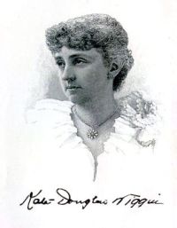
Kate Douglas Smith Wiggin,
Rose o' the River
“ Wiley, an’ we’ll hear the rest to-morrer; only don’t you forgit nothin’! Remember’t was the Kennebec you was talkin’ about.”“I will, indeed,” responded the old man. “As I was sayin’ when interrupted, I may be a stranded log, but I’m proud that the mark o’ the Gard’ner Lumber Comp’ny is on me, so’t when I git to my journey’s end they’ll know where I belong and send me back to the Kennebec. ”
Archer Butler Hulbert,
Portage Paths: The Keys of the Continent
“ This was Arnold’s route, already referred to by Mr. Sullivan. Ascending the Dead to “The Amaguntic Carrying Place” (a portage of about four miles) the route is marked to “the River of Mekantique” and through “The meadow of [Pg 112] Mekantique;” thence through “Lake of Me’ Kantique de St Augustin” and into the Chaudière.Perhaps the earliest map showing a road throughout the Kennebec and Chaudière valleys is “A New Map of Nova Scotia & Cape Britain” (1755) in the British Public Records Office. [39] The road bears the name “Kenebec Road.” ”
Various, The New England Magazine Volume 1…
“ Hundreds of storehouses of immense proportions were erected during the summer months, and for several successive winters the river and adjacent streams were the scene of a feverish excitement. Every dollar that could be obtained was invested in a claim, and some farmers upon the shores mortgaged their possessions in the desire to embark in the enterprise. The ice-crop had sustained such a total failure upon the Hudson, for one or two seasons, that the Kennebec furnished the only extensive field for this product. ”
Various, The Atlantic Monthly, Volume 02…
“ At length a Mr. Hinckley, who has a camp at the other end of the "carry," appeared with a truck drawn by an ox and a horse over a rude log-railway through the woods. The next thing was to get our canoe and effects over the carry from this lake, one of the heads of the Kennebec, into the Penobscot River. This railway from the lake to the river occupied the middle of a clearing two or three rods wide and perfectly straight through the forest. We walked across while our baggage was drawn behind. My companion went ahead to be ready for partridges, while I followed, looking at the plants. ”
Sir Charles Prestwood Lucas, A Historical Geography of the British Colonies…
“ Lawrence to a breadth of considerably less than a mile. Above Quebec the upward course of the river is still south-west by west. The northern bank is continuously steep, and at five to six miles' distance from Quebec on this side is Sillery Cove. Between two and three miles further on, nearly due west, is Cap Rouge. Over against Sillery the Chaudière river flows in from the south, forming in old days a possible route to the St. Lawrence for those who followed up the course of the Kennebec from the coast of Maine.99 See above. ”
Various, The Atlantic Monthly, Volume 17…
“ Beyond the road rolls the Kennebec, here two or three hundred yards wide. Putting my head out of the window, I can see it flowing steadily along straightway between wooded banks; but arriving nearly opposite the house, there is a large and level sand island in the middle of the stream; and just below the island the current is further interrupted by the works of the mill-dam, which is perhaps half-finished, yet still in so rude a state that it looks as much like the ruins of a dam destroyed by the spring freshets as like the foundations of a dam yet to be. ”
Joel Cook,
America, Volume 5 (of 6)
“ The Kennebec, turning grandly to the eastward, five miles below pours over the falls of Skowhegan, descending twenty-eight feet upon rough ledges, having a picturesque island ending at the crest of the cataract, with the stream beyond compressed within the high, rocky walls of a canyon. Here are numerous factories and a population of six thousand. ”
Olaf Baker, Shasta of the Wolves
“ When Kennebec thought wickedly some one was sure to suffer. He would sit on the pointed summit of a crag, which was now worn smooth with the constant gripping of his great claws, and his wonderful eyes would shine with a strong light. Down below him, for a thousand feet, the tops of the spruces made the forest look like a green carpet worn into holes. And beyond that, to the south, the lake glimmered and shone, and the Sakuska showed in loops of silver. Over the lake Kennebec could see the fish-hawks at their fishing. ”
William H. C. Folsom, Fifty Years In The Northwest
“ The southern townships are heavily timbered with hardwood and are rapidly being converted into good wheat farms. A large quantity of cordwood, piles and [Pg 261] ties is annually marketed by means of the railroad. Kanabec river is navigable from Chengwatana and Pine City to Brunswick, in Kanabec county. The same steamboat that since 1881 has navigated the Kanabec, also makes trips, six miles up the Rice and Pokegama rivers. ”
Charles Lanman,
A Tour to the River Saguenay, in Lower Canada
“ Two hours more passed on, one small moose was killed, and at day-break we were in our cabin fast asleep.The principal outlet of Moosehead Lake is the Kennebeck, which now “demands my song.” It is the second river in Maine, and one of the most beautiful I have ever seen. Instead of watering a wilderness, as I had supposed, all along its valley, for over a hundred miles, are fertile and extensive farms, with here and there a thriving village, inhabited by an intelligent and industrious people. Its principal tributary is Dead River, and the spot at the junction of the two is called the Forks. ”
Edward Chappell, Narrative of a Voyage to Hudson's Bay in His Majesty's Ship Rosamond
“ One of the small islands in the centre of Knee Lake contains so great a quantity of iron ore, as to cause the compass to spin round with uncommon velocity. At the upper end of the lake the stream gradually lessens into another slip, called Trout River, and here are four more portages: then gently extending its boundaries, the river opens on a wide expanse, called Holey Lake, from some deep holes in the bottom of it, and the great inequality of the soundings throughout. At the eastern extremity of this lake stands Oxford House, the first trading port to be met with after leaving the factory. ”
John S. Springer, Forest Life and Forest Trees: comprising winter camp-life among the loggers…
“ Richmond, Gardiner, Pittston, and some other towns on the river, have also built many fine vessels. From Merry-meeting Bay (the confluence of the Kennebeck and Androscoggin from the west) to the Dead River is a fine farming country, while the lumbering region on the Kennebeck, for the most part, extends northward to the lake, around it and its tributaries, and at the Dead River. Formerly a considerable quantity of lumber was cut on the Sebasticook; but now the quantity is very much diminished, owing to the scarcity of logs on that river. ”
Mosaic of New Mexico's Scenery…
“ The reservoir 109 serves many purposes: flood control, local irrigation, camping and boating facilities, and fishing and water skiing.The Canadian River has its origin on Raton Mesa and flows southward to Conchas Dam, then turns abruptly eastward. On its way across the High Plains, it cuts into some of the oldest rocks that can be seen on the western edge of the plains, the Dockum Group of Late Triassic age. The best place to view the earth-building processes of this region is where State Highway 120 crosses the gorge of the Canadian River between Wagon Mound and Roy. ”
George Kennan,
Siberia and the Exile System
(1891)
“ The left bank, it is true, is generally low and uninteresting; but on the other side the land rises abruptly from the water's edge to a height of 400 or 500 feet, and its boldly projecting promontories, at intervals of two or three miles, break up the majestic river into long, still reaches, like a series of placid lakes opening into one another and reflecting in their tranquil depths the dense foliage of the virgin forest on one side and the bold outlines of the half-mountainous shore on the other. ”
George Kennan,
The Salton Sea: An account of Harriman's fight with the Colorado River
(1917)
“ The most serious problem with which engineers have to deal in the irrigation of arid land from a turbid river is the getting rid of silt, and this problem is a particularly difficult one in the Imperial Valley, owing to the immense amount of sediment that the irrigating water contains. The Colorado River, until after it passes the Grand Cañon, is almost everywhere a swift, turbulent stream, with great eroding capacity. ”
1911 Encyclopædia Britannica, Volume 16… (1911)
“ It collects the waters of many rivers, the chief being Rainy river from the east, draining Rainy Lake. By the Winnipeg river on the north-east it discharges into Lake Winnipeg. At its source Winnipeg river is 1057 ft. above the sea, and drops 347 ft. in its course of 165 m. The scenery both on and around the lake is exceedingly beautiful, and the islands are largely occupied by the summer residences of city merchants. Kenora, a flourishing town at the source of the Winnipeg river, is the centre of the numerous lumbering and mining enterprises of the vicinity. ”
“ The road that but a moment before had made a feint of stopping for good and all at a dark and hilly wall of cedars, swept around a rocky curve and revealed the glint of the river. After that by all the dictates of convenience it should have curved again and continued its course to Kenny's destination, pleasantly parallel with the bends of the river. Instead it crossed the river bridge and went off at a foolish tangent, disappearing over the crest of a hill. Wild and wooded country swept steeply down to the river edge. ”
Sir Alexander Burnes, Travels into Bokhara (Volume 3 of 3…
“ The Chenab, indeed, is only inferior to the Indus; its current is more rapid than that river, and, with its depressed banks, it yet preserves every where a depth of two fathoms. The Ravee throws itself into the Chenab by three mouths, close to each other. This river is very small, and resembles a canal, rarely exceeding 150 yards in breadth in any part of its course. Its banks are precipitous, so that it deepens before it expands. ”
The Jesuit Relations and Allied Documents…
“ The water of an entire river often falls in the form of an arch, in such fashion that it is possible to walk dry-shod beneath the stream which rushes overhead. The savages, when they come to such a spot, shoulder their boats, which are constructed of light bark, and carry them, together with the baggage, to the calm portion of the river flowing below. The chief city of new France is called Kebec, and is situated on the St. Lawrence river. The whole country possesses a healthful climate, but is harassed by a cold and long winter. ”
Howard Angus Kennedy, The Book of the West
“ A noble valley this, now spreading wide, now narrowing to a canyon where the Ramparts rise hundreds of feet sheer up from the river’s edge, now opening again to show green meadows and woodland. Here, a mountainous Mackenzie and Peace Rivers region is densely clad with spruce; there, light birch and poplar restore life to a stretch of brulé; jack-pine and tamarack vary the scene; and yonder a gaunt escarpment of bare rock climbs to a height of 3,000 feet.If we followed the Mackenzie through all its windings, we should find it the longest river in Canada, 2,500 miles to the head of the Finlay. ”
With the World's Great Travellers…
“ To say that the Winnipeg River has an immense volume of water, that it descends three hundred and sixty feet in a distance of one hundred and sixty miles, that it is full of eddies and whirlpools, of every variation of waterfall from chutes to cataracts, that it expands into lonely pine-cliffed lakes and far-reaching island-studded bays, that its bed is cumbered with immense wave-polished rocks, that its vast solitudes are silent and its cascades ceaselessly active,—to say all this is but to tell in bare items of fact the narrative of its beauty. ”