Ancre River

Definition and stakes

Bernard Adams,  Nothing of Importance

“ TRENCH LINE —·—·—·—·—·—
Now look at Map II. The River Ancre runs down west of the Thiepval ridge, through Albert, and then in a south-westerly course through Méricourt-l’abbé down to Corbie, where it joins the Somme on its way to Amiens. On each side of the Ancre is high ground of about 100 metres. The high ground between the Ancre and the Somme forms a long tableland. There is no ridge, it is just high flat country, from three hundred and thirty to three hundred and forty feet, cultivated and hedgeless. Now look at Fricourt.
”
Source: Gutenberg

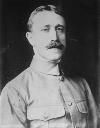
Portrait of Frederick Palmer Frederick Palmer,  My Second Year of the War

“ A river so-called, really a brook, the Ancre, runs at the foot of the slope and turns eastward beyond Thiepval, where a ridge called Crucifix Ridge north-east of the village takes its name from a Christ with outstretched arms visible for many miles around. Then on past the bend of the Ancre the British and the German positions continued to the Gommecourt salient.
Along these five miles the odds of terrain were all against the British. The high ground which they sought to gain was of supreme tactical value. Nature was an ally of soldierly industry in constructing defenses.
”
Source: Gutenberg

The New International Encyclopædia…

“ It rises in Central Colorado, flows east into Kansas, and out again east of the middle of the south boundary of the same State, southeast across Oklahoma and Indian Territories, and diagonally across Arkansas, bisecting it into nearly equal parts, and emptying into the Mississippi. The river is about 2000 miles long, navigable for 650 miles, and drains an area of 188,000 square miles. Much of the water in its upper course is used for irrigation purposes. In Fremont County, in Central Colorado, it flows through the Royal Gorge, one of the deepest cañons in the United States. ”
Source: Wikisource

Get perspective with Kwize: daily news enlightened by great literature