“ And at the roots of every tree uninvited primroses and violets were crowding out the earth.She followed the winding terraces towards the gleaming river, past fluttering daffodils and wandering narcissi, over riotous anemones and bright sturdy scyllæ, shaking showers of diamonds off the grasses as she went.The river lay like a long satin streamer, a curling ribbon dropped on the meadows. And everywhere, hidden and vibrating, was an urgency of life: buds bursting into blossom, birds bursting into flight. ”
Biobío River
Definition and stakes
Quotes about “Biobío River”
Millicent Todd Bingham,
Peru: a land of contrast
(1914)
“ Sometimes there is an awful, rumbling noise, like an approaching earthquake. Then the waters of the river are churned like the smallest mountain torrent tumbling over a rock in mid-stream. The great snake lifts her head, then her heavy body from the stream bed, and crashes off through the jungle. The track she leaves behind her is a desert waste; no growing thing is left, and the wake is as broad, why, as broad as this stream, under which she is now lying,” and he pointed with wide eyes to the water, rushing headlong to join the Amazon. ”
Lardner Gibbon, Lieutenant, U.S.N., Exploration of the Valley of the Amazon… (1854)
“ On the seventh day after leaving the town, the canoe touched the waters of the Paraguay river, the banks of which are inhabited by a nation of Indians called “Guatos,” who came off in a friendly way to offer fish for sale, and were delighted to receive payment in a glass of rum. On the Bolivian shore, opposite the mouth of the Cuyaba, the land is hilly, the elevations range with the stream, and also stretch back into the Bolivian territory. Among these hills is a large lake, called Gaiba. ”
Lardner Gibbon,
Exploration of the Valley of the Amazon…
“ September 22.—The river below Bananeira falls is seventy-eight feet deep and half a mile wide, passing through rocks and islands, where we found the wild Muscovy duck. With a rapid current, we soon reached the mouth of the Yata river, a small stream flowing from the territory of Bolivia, not navigable for a vessel larger than a ship's boat. At "Pau Grande" rapids, the country is hilly on both sides, and wooded with large trees, from which fact the rapids derive their name. ”
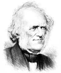
Sir Charles Lyell,
Principles of Geology
“ This tree resists the action of air and water longer than any other, and, if not submerged throughout the whole year, will retain life for an extraordinary period. Lake Bistineau, as well as Black Lake, Cado Lake, Spanish Lake, Natchitoches Lake, and many others, have been formed, according to Darby, by the gradual elevation of the bed of Red River, in which the alluvial accumulations have been so great as to raise its channel, and cause its waters, during the flood season, to flow up the mouths of many tributaries, and to convert parts of their courses into lakes. ”
Dean C. Worcester, The Philippines: Past and Present…
“ Pleasurable river navigation is by no means confined to underground streams. In Mindanao there are two rivers which offer strong attractions to tourists. One may ascend the Rio Grande de Cotabato through fertile plains, to a remarkable series of lakes swarming with great tame crocodiles and with a wonderful variety of waterfowl. On this trip one will see the Moros at home. The Agusan River, which rises near Davao Gulf and empties on the north coast of Mindanao, is the largest navigable stream in the islands. During ordinary weather it is strictly confined between well-marked banks. ”
Lardner Gibbon,
Exploration of the Valley of the Amazon…
“ The river is five hundred yards wide, with a depth of from thirty to sixty feet. The country on both sides of us appears well adapted for cultivation, many parts of it being above the rising of the floods. Pedro tells me we have the "Sinabos" savages on the Brazil side of us, and the equally uncivilized tribe of "Jibo" on the Bolivia side. Our men work well; with a one-mile current, we keep on day and night. Large green and black flies annoy us very much, in addition to which we have sand-flies and musquitoes at night. At 3 p. m., thermometer, 87°; water, 80°; wind southeast. ”
Henry Walter Bates,
The Naturalist on the River Amazons…
(1863)
“ August 5th.—The river reminds me of some parts of the Jaburú channel, being hemmed in by two walls of forest rising to the height of at least 100 feet, and the outlines of the trees being concealed throughout by a dense curtain of leafy creepers. The impression of vegetable profusion and overwhelming luxuriance increases at every step. The deep and narrow valley of the Cuparí has a moister climate than the banks of the Tapajos. We have now frequent showers, whereas we left everything parched up by the sun at Aveyros. ”
A. F. R. Wollaston, Pygmies & Papuans: The Stone Age To-day in Dutch New Guinea
“ Those days of canoeing up the Mimika River were some of the most monotonous of my life and I shall never forget them. For the first few miles above Wakatimi the river is about as wide as the Thames at Windsor, the banks are covered with smallish trees with here and there clumps of palm trees, from which fresh young coconuts may be gathered. Occasionally the rising tide helps you on your way, and if you are particularly fortunate you may even see at the end of a straight reach of the river a glimpse of the distant mountains. ”
Julius Beerbohm, Wanderings in Patagonia; Or, Life Among the Ostrich-Hunters
“ With drooping reins we rode slowly on till we got to the river, now no longer the shallow stream which in summer one can wade over knee-deep, but a broad torrent, which eddied, swirled, and foamed, as it dashed rapidly over its stormy bed through banks which were already growing too narrow for its swollen waters. In the middle we could still see a single tuft of long grass, which was bending with the current, and this, Isidoro told me, grew on a little island, which when the river is fordable, 118 is several feet above the water's level. ”
Various, Popular Science Monthly (1902)
“ The amount of storage in Lake Bohio between the elevations of 85 and 82 ft. above sea-level, as designed, is sufficient to supply the needs of that traffic in excess of the smallest recorded low-water flow of the Chagres River during the dry season of a low rainfall year. ”
1911 Encyclopædia Britannica (1911)
“ The rivers of the narrow mountainous peninsulas form many rapids and cataracts; as the Tondano, draining the lake of the same name to the north-west coast of Minahassa at Menado; the Rano-i-Apo, flowing over the plateau of Mongondo to the Gulf of Amurang; the Poigar, issuing from a little-known lake of that plateau; the Lombagin, traversing narrow cañons; and the river of Boni, which has its outfall in the plain of Gorontalo, near the mouth of the Bolango or Tapa, the latter connected by a canal with the Lake of Limbotto. ”
Millicent Todd Bingham,
Peru: a land of contrast
(1914)
“ The temple of the speaker was in ruins long before Spanish days.Like other streams of the west coast, the great river Rimac has run through the gamut of all zones. Hurrying down from the cordillera, it spreads fertility far and wide over the dry shore-valley. As far away as Chorillos, “little water jets,” the water of the Rimac filters through, led astray for irrigation. But its own journey to the sea is vain. The mountain water is so precious to the desert that by the time the stream has reached the shore, it has not force enough left to make an outlet across the beach into the ocean. ”
Lardner Gibbon, Lieutenant, U.S.N., Exploration of the Valley of the Amazon… (1854)
“ Our cargo was landed, and while Richards, with one man, was engaged carrying the baggage down, I took the boat over on the Bolivian side, and we hauled her three hundred yards over the rocks and through the small channels, down an inclined shelf of about twelve feet fall. The main channel is in the middle of the river, with waves rolled up five feet high by the swiftness of the current, through which a steamboat could pass neither up nor down. The river cuts its way through an immense mass of rock, stretching across the country east and west like a great bar of iron. ”
Sir Woodbine Parish,
Buenos Ayres and the Provinces of the Rio de La Plata
“ Two days after passing Puelec, whence the river Cobu-leubú takes a southerly course, and having gone about seventy-four leagues by their daily computation from Antuco, the travellers reached the river called by the Indians Chadi-leubú, or the Salt River (probably a continuation of the Atuel) , which, uniting with the Desaguadero, or Drain of the Diamante, about five leagues below where they crossed it, discharges itself into a vast lake about ten leagues further south, called by the Indians the Urré-lauquen, or the bitter lake. ”
In Far Bolivia: A Story of a Strange Wild Land
“ This last is called the Maya-tata by the Bolivians.It is a beautiful stream, overhung by hill and forest, and rises fully two hundred miles southward and west from a thousand little rivulets that drain the marvellous mountains of Karavaya.The Beni joins this river about ten or twelve miles above the banks of the Madeira. It lies farther to the south and the east, and may be said to rise in the La Paz district itself, where it is called the Rio de la Paz. ”
Various, Encyclopaedia Britannica, 11th Edition…
“ The south-east drainage basin, which is smaller and economically less important than that of the Madeira, discharges into the Paraguay and extends from the Sierras de Chiquitos south to the Argentine frontier, and from the Cordillera Oriental east to the Paraguay. It possesses only one large river in Bolivia, the Pilcomayo, which rises on the east slopes of the Cordillera Oriental opposite the south end of Lake Pampa Aullaguas and flows east and south-east through the sierra region to the Bolivian Chaco. ”
Arnold Henry Savage Landor,
Across Unknown South America
“ We rose upon yet another dome, and then descended to the Rio Manso or Rio das Mortes, the head-waters of which were not far from there, to the south-west, in the Serra da Chapada. The river was there only 15 metres wide, but too deep and rapid for the animals to ford, so we had to follow its bank in order to find a suitable spot. The River das Mortes flowed, roughly, first in an easterly then in a north-easterly direction, and soon, swollen by innumerable streams, became the most powerful tributary of the Araguaya River, which it met almost opposite the centre of the great island of Bananal. ”
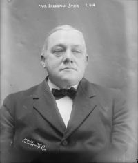
Frederick Starr,
Liberia: Description, History, Problems
“ These lagoons open onto the sea at the mouths of the more important rivers; smaller rivers in considerable numbers enter them so that in reality almost every river-mouth in Liberia may be considered not the point of entrance of a single river, but of a cluster of rivers which have opened into a common reservoir and made an outlet through one channel. As good examples of these curious lagoons, we may mention from west to east the Sugari River, Fisherman’s Lake, Stockton Creek, Mesurado Lagoon, Junk River, etc., etc. ”
Alexander Jardine, Narrative of the Overland Expedition of the Messrs…
“ The principal timber being bauhinia, suggested the name of "Bauhinia Plains." Their width back from the river extended to an average of six miles, when they were bounded by low well-grassed iron-bark ridges. The river was broad and sandy, running in two or three channels, and occasionally spreading into long reaches. Large ana-branches, plentifully watered, left the main channel running back from it from 1 to 3 miles. A great many fishing weirs were observed in the channels of the river, from which it would appear that the blacks live much, if not principally, on fish. ”
William Bingley, Travels in North America, From Modern Writers
“ They subsequently found many evacuated camps of Indians.On the 18th of December, they came to a stream, about twenty-five yards in width, which they erroneously supposed to be a branch of the Red river. Its current flowed with great rapidity, and its bed was full of rocks. On ascending this river, to examine its source, it was found to run close to the mountains, in a narrow and rocky channel; and to have its banks bordered with pine-trees, cedar, and other kinds of timber. The whole party suffered extremely from cold; their clothing being frozen stiff, and their limbs considerably benumbed. ”
Lardner Gibbon,
Exploration of the Valley of the Amazon…
“ He carried down thirty-five trunks or packages of goods, and the people of the river still talk of his articles of luxury; but in passing one of the malos pasos, or rapids of the river, his boat capsized, and he lost everything. The Indians here had blue limestone, which they were burning to mix with their coca. July 31.—I bathed in the river before starting. This is wrong in so humid an atmosphere. I became chilled, and did not get over it for some hours. A native traveller in these parts will not even wash his face and hands before the sun is well up. ”
Sir Richard Francis Burton,
The City of the Saints, and Across the Rocky Mountains to California
“ The Green River is the Rio Verde of the Spaniards, who named it from its timbered shores and grassy islets: it is called by the Yuta Indians Piya Ogwe, or the Great Water; by the other tribes Sitskidiágí, or “Prairie-grouse River.” It was nearly at its lowest when we saw it; the breadth was not more than 330 feet. In the flood-time it widens to 800 feet, and the depth increases from three to six. During the inundation season a ferry is necessary, and when transit is certain the owner sometimes nets $500 a week, which is not unfrequently squandered in a day. ”
Lardner Gibbon,
Exploration of the Valley of the Amazon…
“ The river was thirty feet above its present level, in the rainy season, and has now thirty feet depth off Borba. A vessel may lay moored to the bank of the river. There is stone at hand for building wharves if needed. The northeast trade-winds blow fresh, and we find a difficulty in making head-way; the current of the river has slackened to half a mile per hour. The winds blow directly in opposition to it, which baffles us considerably. In the evening, the wind falls away, and we push off from the bank where the boat is fastened, to hold what we have gained. ”
Theodore Roosevelt,
Through the Brazilian Wilderness
“ It is a hazardous thing to descend a swift, unknown river rushing through an uninhabited wilderness. To descend or ascend the ordinary great highway rivers of South America, such as the Amazon, Paraguay, Tapajos, and, in its lower course, the Orinoco, is now so safe and easy, whether by steam- boat or big, native cargo-boat, that people are apt to forget the very serious difficulties offered by the streams, often themselves great rivers, which run into or form the upper courses of these same water highways. ”
Julius Beerbohm, Wanderings in Patagonia; Or, Life Among the Ostrich-Hunters
“ South of Chubut lies Port Desire, formed by the estuary of the river, or rather stream, of that name. The Desire does not rise in spring and summer, like Gallegos and the other Patagonian rivers, to any great extent—a circumstance which makes it probable that it does not take its source in the Cordilleras, but rather from a chain of hills, which, according to Dr. Moreno, traverses the centre of Patagonia, running south-southwest from the Sierra de San Antonio, near the Gulf of San Matias. ”
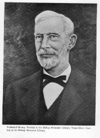
Nathaniel H. Bishop,
Voyage of the Paper Canoe
“ Lawrence at the two Bic Islands, where it has a width of about twenty miles. By consulting most maps the reader will find that geographers carry the river nearly two hundred miles beyond its usual current. In fact, they appropriate the whole estuary, which, in places, is nearly one hundred miles in width, and call it a river — a river which lacks the characteristics of a river, the currents of which vary with the winds and tidal influences, and the waters of which are as salt as those of the briny deep.Here, in the mouth of the river, at the Bics, secure anchorage for vessels may be found ”
Edward Davis Mathews, Up the Amazon and Madeira rivers… (1879)
“ The river Yacuma is said to be navigable all the year round for large canoes, and is free from savages; therefore a small steamer may be advantageously employed here, after the construction of the railway of the cachuelas. The Beni River is said to be known from its sources, near La Paz, down to Cavinas, where there is a small village and a mission; but below that point few persons, if any, have of late years navigated, for the savages, who infest the lands near the junction of the Beni and the Mamoré, at the Madeira Falls, are much dreaded. ”
Lardner Gibbon,
Exploration of the Valley of the Amazon…
“ The Aguaytia and Pishqui are also small streams, where the Indians have to wade and drag the canoes. October 16.—Started at 6 a. m.; stopped at half-past five opposite the mouth of the river Catalina. It seemed thirty yards wide, and had a small island in front. The ascent of the river is very tedious; we barely creep along against the force of the current, and day after day "wearies by" in the most monotonous routine. I frequently land, and with gun on shoulder, and clad only in shirt and drawers, walk for miles along the beaches. ”