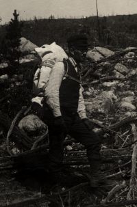
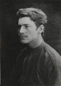
“ In front of one of them there was a bulletin-board demand for railroad grade laborers on the Cripple Creek branch of the Colorado Midland. At that time I knew next to nothing about the geography of the Rocky Mountain States, and the great mining-camp at the back of Pike's Peak was merely a name to me; though the name was familiar, in a way, because the mine in which Abel Geddis had sunk his depositors' money was said to be in the Cripple Creek district. What chiefly attracted me in the bulletin-board notice was the announcement that free transportation would be given to the work. ”
Cripple Creek, Colorado
Definition and stakes
Quotes about “Cripple Creek, Colorado”
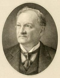
James W. Steele, Colorado Outings
“ There are places where the sun does not shine; others where the walls widen a little and one catches a glimpse of white peaks far off. Foaming along the bottom runs Clear Creek—now often of a color far from clear because of its admixture with tailings from extensive mining operations far toward its head. It is 26 useless, here or elsewhere, to try to describe these Colorado torrents. They make a picture upon the inner consciousness, and one can shut his eyes long afterward and see and hear them. ”
Various, Encyclopaedia Britannica, 11th Edition…
“ Colorado Springs is superbly situated where the Rocky Mountains rise from the great plains of the prairie states, surrounded on all sides by foothills save in the south-east, where it is open to the prairie. To the south of the mesa (tableland) on which it lies is the valley of Fountain Creek. To the west is the grand background of the canyon-riven Rampart range, with Pike’s Peak (q.v.) dominating a half-dozen other peaks (among them Cameron Cone, Mt. Rosa, Cheyenne Mt.) 9000 to 12,000 ft. in height. Monument Creek traverses the city. The streets are of generous width (100-140 ft.) ”
John Wesley Powell,
Canyons of the Colorado
“ The Virgen, Kanab, Paria, Escalante, Fremont, San Rafael, Price, and Uinta on the west, the Grand, White, Yampa, San Juan, and Colorado Chiquito on the east, have also cut for themselves such narrow winding gorges, or deep canyons. Every river entering these has cut another canyon; every lateral creek has cut a canyon; every brook runs in a canyon; every rill born of a shower and born again of a shower and living only during these showers has cut for itself a canyon ”
John Wesley Powell,
Canyons of the Colorado
“ Each creek has its system of side streams and each side stream has its system of laterals, and again these are divided; so that this outstretched slope of rock is elaborately embossed. Beds of different-colored formations run in parallel bands on either side. The perspective, modified by the undulations, gives the bands a waved appearance, and the high colors gleam in the midday sun with the luster of satin. We are tempted to call this Rainbow Park. Away beyond these beds are the Uinta and Wasatch mountains with their pine forests and snow fields and naked peaks. ”
“ Goin up Cripple Creek to see my little girlNow, Cripple Creek's wide and Cripple Creek's deep Wade old Cripple Creek before I sleep Hills are steep and the roads are muddy and I'm so dizzy that I can't stand steady I'm ”
John Wesley Powell,
First through the Grand Canyon
“ August 16.—We must dry our rations again to-day, and make oars.The Colorado is never a clear stream, but for the past three or four days it has been raining much of the time, and the floods, which are poured over the walls, have brought down great quantities of mud, making it exceedingly turbid now. The little affluent, which we have discovered here, is a clear, beautiful creek, or river, as it would be termed in this western country, where streams are not abundant. ”
Theresa V. Francis, Crystal River Saga: Lore of the Colorado Rockies
“ The wagon road up the Crystal River from Carbondale is progressing quite favorably and our citizens are in hopes it will be completed this fall.THE MARBLE CITY TIMES and Clarence Chronicle Sept. 8, 1893In the Little Jessie mine on Yule Creek, there is from four to six feet of lead ore exposd in the workings, which runs well in lead and silver. The ore body is opened up in two places and shows up well. ”
F. C. Grable, Colorado—The Bright Romance of American History
“ From this place, he made a sketch of Pike's Peak, and is "charmed with the view of the valley of Fountain Creek," on which Manitou and Colorado Springs are located, and which he reached a little north of its junction with the Arkansas River. He speaks of finding at this point a "Pueblo" where a settlement of mountaineers were living, married to Spanish wives, "who had collected together and occupied themselves with farming, and a desultory Indian trade." They had come from the Taos Valley settlements, the Valley that was later named the Rio Grande. ”
Junius Henderson,
Field Notes of Junius Henderson
“ Strong west wind but warmer than yesterday. Dodds and I started for Sand Creek Sand Creek, Colorado at 8 a.m. finding a much easier trail over the high Lyons ridge and down to the creek. The east slope of the Lyons escarpment is approximately the same as the dip at the contact between the Lyons and the Lykins formations, the latter lying apparently conformably on the former toward the base of the slope, having been eroded from the upper part of the slope. ”
The New International Encyclopædia…
“ It receives a number of tributaries, chiefly from the south; among these are Sulphur Creek, and the Concho, San Saba, and Llano rivers. The chief towns on its course are Bay City, Wharton, Columbus, Lagrange, Bastrop, and Austin. It is about 900 miles long, and in winter is navigable for river steamboats to Austin. ”
Arthur J. Hoskin, The Business of Mining
“ In the Cripple Creek District, the ground is criss-crossed in every direction by tiny fissures which have resulted from the contraction of the country rock, just as a bed of mud is fissured in the process of drying up after a rain. ”
Junius Henderson,
Field Notes of Junius Henderson
“ Robbins and I started out at 9 a.m., going up to Flag Creek Flag Creek, Colorado road to cross river to south side. The valley here occupies the upper Mancos formation, with Mesa Verde forming strong bluffs on North side. Dip approximately 15° NW. The Mesa Verde, as usual, is composed mainly of sandstones, with some shales. Several coal veins crop out along the bluffs, at least one of which is being worked. Where we reached the south side of the river a low bluff is composed of shaley sandstone like portions of the Pierre north of Boulder Boulder, Colorado. ”
Henry Villard,
Memoirs of Henry Villard
(1904)
“ Thousands followed the South Platte to its sources, and thence reached the western slope through the Ute Pass. In fact, before the next winter set in, the greater part of the territory now included in the boundaries of the State of Colorado had been journeyed and worked over, and in many places permanent mining-camps established. Almost every day, reports of new “strikes” in various parts of the mountains reached the Cherry Creek towns. As soon as they were sufficiently confirmed to warrant it, I set out to verify them on the spot. Thus I was “on the go” the greater part of the time. ”
| override_editor, Encyclopædia Britannica, Ninth Edition…
“ After receiving the waters of the Yampuh and the White River, it flows south for about 150 miles without any important augmentation till it meets with the great rival stream of the Grand River, which by means of its numerous confluents drains so large a portion of the western versant in the State of Colorado. The united stream continues to force its way south, till at its junction with the Colorado Chiquito, or Little Colorado, which takes its rise in the Sierra Madre of New Mexico, it turns almost due west, and cuts right athwart the line of the mountain ranges. ”
Junius Henderson,
Field Notes of Junius Henderson
“ Here, as on Ten Mile Creek Tenmile Creek, Colorado, the Fountain is not nearly as conglomeratic as it is southward. The Carboniferous escarpment, except for the l.s. beds is just as in the Belleview fold above the Fountain. Below the limestones the sandstones and conglomerates are decidedly darker, less of a pink and more of a red. Found Productus cora Productus cora and fine calcite crystals in next to top limestone in Owl Canyon Owl Creek Canyon, Colorado. Loaded plate holders and went to bed early. Livermore, Colo. Livermore, Colorado, Aug. 13, 1908 August 13, 1908 Bright morning. ”
Theresa V. Francis, Crystal River Saga: Lore of the Colorado Rockies
“ The scenic grandeur of the Crystal River cannot be excelled; sometimes narrow canyons, precipitous cliffs and steep waterfalls; sometimes broad valleys heavily wooded with stately ponderosa pine, Engelmann spruce, Colorado green spruce, blue spruce, Douglas fir, the narrow leaf cottonwood, and the quaking aspen; carpeted with waist high ferns, Oregon grapes, and kinnikinnick (sometimes called Indian tobacco) interspersed with brilliant flowers of every hue, and often rare plants found only in much warmer climes. ”
Frederick Samuel Dellenbaugh,
The Romance of the Colorado River
“ From the tiny rivulets of its snowy birth to the ferocious tidal bore where it dies in the sea, it wages a ceaseless battle as sublime as it is terrible and unique. Such is the great Colorado River of the West, rising amidst the fountains of the beautiful Wind River Mountains of Wyoming, where also are brought forth the gentler Columbia and the mighty, far-reaching Missouri. Whirling down ten thousand feet in some two thousand miles, it meets the hot level of the Red Sea, once the Sea of Cortes, now the Gulf of California, in tumult and turmoil. ”
Various, The Atlantic Monthly, Volume 13…
“ The Colorado is almost the only other large river created from many tributaries, which debouches between the Columbia and the Isthmus,—and that rises east of the mathematical axis of the Rocky Mountains. The Yo-Semite valley is one of the cradles through which the short Sierra-draining rivers reach the ocean; its threading stream is the Merced ”
Joel Cook,
America, Volume 6 (of 6)
“ The adjacent gorge of the Cimarron, a tributary stream, gives also a splendid display of Rocky Mountain wildness, and below it the river passes through the Lower Gunnison Canyon, bounded by smooth-faced sandstone cliffs, and finally it falls into Grand River, one of the head-streams of the Colorado. The combined magnificence of these canyons and mountains makes the environment of the Colorado mining region one of the most attractive scenic districts in America. ”
Frederick Samuel Dellenbaugh,
The Romance of the Colorado River
“ There are two grand divisions: the lowland or desert, below the Virgen, and the plateau, but the topography of the immediate river course separates itself into four parts, the Green River Valley, the canyon, the valley-canyon, and the alluvial. The canyon part is the longest, occupying about two-thirds of the whole, or about 1200 miles. It is cut mainly through the plateaus. The last of these southward is the Colorado, a vast upheaval reaching from the lower end of the Grand Canyon south-east to about where the 34th parallel crosses the western line of New Mexico. ”
Theresa V. Francis, Crystal River Saga: Lore of the Colorado Rockies
“ Four miles below Redstone the Crystal River runs through a district that contains several hot mineral springs that have medicinal value comparable to any in the United States.Soon the canyon widens, sometimes on one side, sometimes on the other, into fertile meadows especially adapted to raising strawberries, raspberries, cherries, and apples. A little farther on there are large ranches bordering it. These raise potatoes, oats, alfalfa, and hay; they all depend on the never failing Crystal River for irrigation. ”
James H. McClintock,
Mormon Settlement in Arizona
“ It would be vain recapitulation to tell just how many times each of the poor struggling communities had to rally back on the sands of the river bed to built up anew the structure of gravel and brush that must be depended upon, if bread were to be secured from the land. The Little Colorado is a treacherous stream at best, with a broad channel that wanders at will through the alluvial country that melts like sugar or salt at the touch of water. ”
J. W. Hawes, The American Cyclopædia (1879)
“ Its highest elevation does not exceed 7,000 ft., which, with its southern location and mild climate, makes it well adapted to agriculture. The park is watered by the Rio Grande and its numerous tributaries, which flow in a southerly direction, and afford abundant water power. Other smaller parks, presenting similar features, are scattered through the mountains W. of the main range. Of this vast region little is known.—The river system of Colorado embraces the principal tributaries of the Rio Colorado, Rio Grande, Arkansas, Platte, and Smoky Hill and Republican forks of the Kansas. ”
Eleanor Colby, Seeing America First, with the Berry Brothers
“ When you stand on the rim of the canyon, the river looks like a little thread of silver ribbon, but if you were to descend 6000 feet, you would discover that the Colorado is a wild, dashing, terrible river—so wild that only a few men have ever tried to launch their boats on it, and some of those few have lost their lives in the attempt. ”
John Wesley Powell,
Canyons of the Colorado
“ The principal tributaries from the south are the Blue, which heads in Mt. Lincoln, and the Gunnison, which heads in the Wasatch Mountains. These streams are also characterized by deep canyons and plateaus, and mesas abound on every hand. Between the Grand River and the White River, farther to the east, the Tavaputs Plateau is found. It begins at the foot of Gore's Pass Range and extends down between the rivers last mentioned to the very brink of Green River, which is in fact the upper Colorado. ”
Halka Chronic, Prairie, Peak, and Plateau: A Guide to the Geology of Colorado
“ Bordering the western side of North, Middle, and South Parks, another long north-south trending ridge extends from the Wyoming border toward the center of Colorado. The northern part of this ridge, forming the western boundary of the main mountain mass in the state, is called the Park Range.The structure of the Park Range is similar to that of the Front Range: a huge linear corrugation in the earth’s crust, bounded by faults. Because this area has fewer resistant sedimentary rock layers above the Precambrian basement rocks, it is not prominently edged with upturned sedimentary layers. ”
Various, Encyclopaedia Britannica, 11th Edition…
“ Its headwaters are known as the Green river, which rises in north-west Wyoming and after a course of some 700 m. due south unites in south-east Utah with the Grand river, flowing down from Colorado, to form the main trunk of the Colorado proper. The Green cuts its way through the Uinta mountains of Wyoming; then flowing intermittently in the open, it crosses successive uplifts in a series of deep gorges, and flows finally at the foot of canyon walls 1500 ft. ”
Halka Chronic, Prairie, Peak, and Plateau: A Guide to the Geology of Colorado
“ One range roughly paralleled the present Front Range, but lay thirty to fifty miles further west. The other extended from the San Luis Valley northwest toward Colorado National Monument, including the area around the Black Canyon of the Gunnison and the present Uncompahgre Plateau. Coarse sediments washed off both sides of both ranges, and accumulated as alluvial fans and valley fill along the mountain margins. These exist today as the Fountain Formation of the eastern Front Range, the Minturn Formation between the ancient uplifts, and the Hermosa Formation west of the western uplift. ”
Hugo Black,
Arizona v. California (373 U.S. 546…
“ The river and its tributaries flow in a natural basin almost surrounded by large mountain ranges and drain 242,000 square miles, an area about 900 miles long from north to south and 300 to 500 miles wide from east to west-practically one-twelfth the area of the continental United States excluding Alaska. Much of this large basin is so arid that it is, as it always has been, largely dependent upon managed use of the waters of the Colorado River System to make it productive and inhabitable. ”
Collier's New Encyclopedia — Colorado River (1921)
“ After absorbing the Gila the river sweeps round in a W. direction for 7 or 8 miles, and soon expands to a width of 1,200 feet. Thence it pursues a tortuous course of 180 miles, the last portion being through Mexican territory to its mouth in the Gulf of California. From the sources of the Green river the Colorado measures a total length of about 2,000 miles. It is navigable for steamers as far as Callville, 612 miles from its mouth, and can be made navigable, it is thought, to the foot of the Grand Cañon, 57 miles higher. ”