Rawalpindi

Definition and stakes

1911 Encyclopædia Britannica, Volume 22… (1911)

“ The District of Rawalpindi has an area of 2010 sq. m., Attock having been separated from it and formed into a separate district in 1904. It is situated on the southern slopes of the north-western extremities of the Himalayas, including large mountain tracts with rich valleys traversed by mountain torrents. It contains the Murree hills with the sanatorium of that name, the chief hill-station in the Punjab. The Indus and the Jhelum are the chief rivers, and the climate is noted for its healthiness. The principal crops are wheat, barley, maize, millets, and pulses. ”
Source: Wikisource

James McCrone Douie,  Provincial Geographies of India (1916)

“ The general height of the plains north of the Salt Range is from 1000 feet to 2000 feet above sea level. The rise between Lahore and Rawalpindi is just over a thousand feet. Low hills usually form a feature of the landscape, pleasing at a distance or when softened by the evening light, but bare and jagged on a nearer view. The chief hills are the Margalla range between Hazara and Rawalpindi, the Kalachitta and the Khairimurat hills running east and west through Attock and the very dry and broken Narrara hills on the right bank of the Indus in the same district. ”
Source: Wikisource

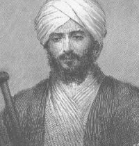
Portrait of G. W. Leitner G. W. Leitner,  Dardistan in 1866, 1886 and 1893

“ As for the places beyond them, our officials at Attock, Peshawur, Rawalpindi, and Abbottabad will deal with the Pathan tribes in their own neighbourhood, which have nothing to do with the adjoining Republics of quiet, brave, and intelligent Dards, on both sides of the Indus, up to Gilgit, to which I have referred, and which deserve our respectful study, sympathy, and unobtrusive support. ”
Source: Gutenberg

Get perspective with Kwize: daily news enlightened by great literature