“ Today the United States Coast and Geodetic Survey carries on the work Hassler started. Using many ships and small boats with marvellous equipment, the scientific men of the sea go about their important and often dangerous work. It’s their job to map the earth that lies under the oceans, rivers and harbors. ”
United States Coast and Geodetic Survey
Definition and stakes
The theme of “United States Coast and Geodetic Survey” has been addressed by authors such as Arthur Mostyn Field, William Petty, Israel C. Russell, G. R. Putnam and Ellen Churchill Semple. It is often associated with terms like coastline, Alaska, ocean, latitude and sea.
Quotes about “United States Coast and Geodetic Survey”
 John Marshall Harlan II,
United States v. California (381 U.S. 139…
John Marshall Harlan II,
United States v. California (381 U.S. 139…
“ We hold that California's position represents the better view of the matter. The Submerged Lands Act defines coastline in terms of the 'line of ordinary low water.' The Convention (Art. 3) uses 'the low-water line along the coast as marked on large-scale charts officially recognized by the coastal State' (i.e., the United States) . We interpret the two lines thus indicated to conform, and on the official United States coastal charts of the Pacific Coast prepared by the United States Coast and Geodetic Survey, it is the lower low water line which is marked. ”
Popular Science Monthly (1872)
“ Pierce showed that the necessities of the Coast Survey extended its operations to all parts of the United States. No science could be divided and separated so as to stand alone. If one begins by measuring his town-lots, the method involves geometry and astronomy, geology and surveying, including ultimately the coast survey. ”
“ On certain small scale charts of the United States Coast Survey which are on the polyconic projection this fact is stated on the chart, and can also be readily recognized by the convergence of the meridians and curvature of the parallels. Gnomonic charts intended for taking off great circle courses are always described in their titles and are also easily recognized by the increased scale and distortion toward all the borders. ”
The New Student's Reference Work (1914)
“ Coast-Survey, of the United States, is an undertaking of great importance. With a long and dangerous seacoast; with thousands of vessels yearly entering and leaving our ports; and with a great coasting trade, it is the duty of the nation to provide every means which science and skill can offer for pointing out the dangers of the coast. The coast-survey was founded for these objects. It furnishes accurate maps of the whole coast, including Alaska ”
 Woodrow Wilson,
State of the Union Addresses
Woodrow Wilson,
State of the Union Addresses
“ But many human lives and many great enterprises hang upon it. It is the matter of making adequate provision for the survey and charting of our coasts. It is immediately pressing and exigent in connection with the immense coast line of Alaska, a coast line greater than that of the United States themselves, though it is also very important indeed with regard to the older coasts of the continent. We can not use our great Alaskan domain, ships will not ply thither, if those coasts and their many hidden dangers are not thoroughly surveyed and charted. The work is incomplete at almost every point. ”
Popular Science Monthly (1875)
“ Where such rigid geodetic operations were instituted previous to the hydrographic survey of the coasts and waters, they furnish the hydrographic surveyor, not only with the correct outlines of the coast, but also with the precise position of the landmarks upon which he may base his work, or, in other words, a skeleton for the same. But, when such surveys are not existing, he is compelled to lay down the coast-line also, with its detail as far inland as there are landmarks auxiliary to navigation, thus performing the labors of the topographer as well as those of the hydrographer. ”
Various, The National Geographic Magazine…
“ This method of determining longitude, introduced, fostered and perfected on the Coast Survey, has been more far reaching than geographical boundaries. All civilized nations have adopted it as the "American Method," and by the greater accuracy and reliability of the results the whole world has profited. The saving that has accrued by the more perfect determination of longitudes and the consequent increased safety to commerce, may be counted by millions every year ”
Popular Science Monthly (1875)
“ The surveys of such localities will only hold good in their general features; in the shore-lines and in the landmarks by which a vessel may approach and feel her way in; the more frequented harbors of this nature require reëxamination from time to time. Several nations have provided for a trigonometrical survey of their coasts only, in advance of geodetical operations embracing their entire domain. ”
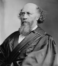 Stephen Johnson Field,
Knight v. United Land Association…
Stephen Johnson Field,
Knight v. United Land Association…
“ The existence of tide-lands in the intersecting water in no respect affects the result. For illustration, in the measurement of a body of water like Long Island sound, when the Connecticut river is met the line of survey does not follow up that river to Hartford because the tide is felt at that place, but it crosses the mouth of the river from headland to headland. So, too, the measurement of Chesapeake bay does not include the Potomac river up to Washington because the tide is felt at the site of the capital. ”
Various, Encyclopaedia Britannica, 11th Edition…
“ It need hardly be said that hydrographic surveys have been of great service to compilers of maps. There are few coast-lines, frequented by shipping, which have not yet been surveyed in a definite manner. In this work the British hydrographic office may justly claim the credit of having contributed the chief share. Great Britain has likewise taken the lead in those deep-sea explorations which reveal to us the configuration of the sea-bottom, and enable us to construct charts of the ocean bed corresponding to the contoured maps of dry land yielded by topographical surveys. ”
Various, The Continental Monthly, Vol. 5…
“ Our coast survey, executed by Professor Bache, Superintendent of the U. S. Coast Survey, exceeds in extent and accuracy that of any other country. On this subject, we have the united opinions of British and Continental savans.We have made since 1790, 1,505,454 linear miles of survey of the public lands of the United States, belonging to the Government, including 460,000,000 of acres already divided into townships, each six miles square (23,040 acres) , subdivided into square miles, called sections, of 640 acres each, and each section further subdivided into 16 lots of 40 acres each. ”
Various, Encyclopaedia Britannica, 11th Edition…
“ A surveyor-general North America. is attached to the department of the interior, at Ottawa. He publishes the topographical maps (1 : 63,366) since 1906. They are based upon theodolite traverses 15 m. apart, and connected with the United States lake and coast surveys, the details being filled in by plane-table surveys on a scale of 1 : 31,680. The contours, 25 ft. apart, depend upon spirit-levelling. In the Rocky Mountains surveys photographic apparatus is successfully employed. ”
by the United States government, Chapters (2002)
“ Today, when survey crews and contractors obtain DGPS positions on prominent shoreline features and compare those positions to the chart, biases may be found that are on the order of two millimeters at the scale of the chart (e.g., 20 meters on 1:10,000-scale chart) . High accuracy aerial photography reveals similar discrepancies between the true shoreline and the charted shoreline. It stands to reason that other important features such as dredged channel limits and navigational aids also exhibit these types of biases. ”
 James Geikie,
Fragments of Earth Lore: Sketches & Addresses Geological and Geographical
James Geikie,
Fragments of Earth Lore: Sketches & Addresses Geological and Geographical
“ Although these regions may be now extending seawards in places, it is obvious that they have recently been subject to submergence. When the fiords of Alaska and British Columbia existed as land-valleys it is probable that a broad land-connection obtained between North America and Asia. The whole Pacific coast is margined by mountain-ranges, which in elevation and boldness far exceed those of the Atlantic sea-board. The rocks entering into their formation range in age from Archæan and Palæozoic down to Cainozoic, and they are almost everywhere highly disturbed and flexed. ”
Various, The National Magazine, Vol. XV, No… (1891)
“ Those who have fancied that Cape Arenas was Cape Cod, and that the bay behind it was Massachusetts Bay, have the same difficulty as regards dimensions. Students of American cartography understand perfectly well that latitudes in the old maps were often more than two degrees out of the way, the instruments of that period being so defective. [9] To convince himself of this fact the reader may compare the reconstructed Map of Chaves with the coast surveys, when the main difference will be found to consist in the exaggeration of Sandy Hook. ”
Various, The National Geographic Magazine…
“ The charting of the great ocean currents, has long been an interesting investigation to hydrographers the world over. A sketch of the efforts, projects, and devices that have been resorted to by the Coast Survey in the attempt to unravel the mysteries of the Gulf Stream, would exemplify the continuous demand for improvement and new exertions under which those employed upon the work have always labored, although the full measure of knowledge sought has not yet been obtained. ”
Various, Popular Science Monthly (1906)
“ All of the larger geographic features have been outlined by the network of explorations which have been extended over the entire territory. There are no new mountain ranges to be discovered, though there are several which are but imperfectly known. In the purely geologic work the results are still more striking. While a decade ago only a few facts about the geology of the coast province was known, it has been possible now to prepare a preliminary map of the geologic features of over half the territory. ”
Popular Science Monthly (1875)
“ In this manner a network of points spread over the globe will be attained, corresponding to the primary and second triangle points of great geodetical operations. The completeness and correctness of a running survey depend upon the time devoted to it and the difficulties encountered; frequently the coast-line is only traced in from point to point, or from the shore-ends of the lines of soundings by the eye ”
“ The land along the whole line of the seacoast is level for a considerable distance into the interior. The breadth of this level tract expands from fifty miles in the north-east extremity, gradually, as we advance to the south-west, till in the state of Georgia, it has attained an extent of near two hundred miles. Beyond this the land gradually rises into mountains, which are much more remarkable for their length and breadth, than their height. They sometimes consist of numerous parallel ridges rising successively behind each other; at other times they run into knots ”
 Hugo Black,
United States v. Louisiana (Louisiana Boundary Case…
Hugo Black,
United States v. Louisiana (Louisiana Boundary Case…
“ Settling and identifying boundaries on land is a surveyor's job; he must go to the land with his instruments and mark it off. Identifying an ocean boundary, we are told by the briefs and arguments of both parties here, is a much more complex job; it takes much time by surveyors, cartographers, photographers, and oceanographers, a knowledge of angles, tides, rolling waters, higher mathematics, etc. [9] Shorelines are constantly changing, and thus under the Court's formula even this painstaking work cannot provide a means of marking the boundary for all time. ”
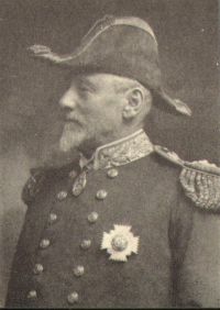 Arthur Mostyn Field,
1911 Encyclopædia Britannica, Volume 26…
(1911)
Arthur Mostyn Field,
1911 Encyclopædia Britannica, Volume 26…
(1911)
“ The distance apart will vary with the depth of water and the nature of the coast; a rocky coast with shallow water off it and projecting points will need much closer examination than a steep-to coast, for instance. The line of prolongation of a point under water will require special care to ensure the fathom lines being drawn correctly. If the soundings begin to decrease when pulling off-shore it is evidence of something suspicious, and intermediate lines of soundings or lines at right angles to those previously run should be obtained. ”
Hugo Black,
United States v. California (381 U.S. 139…
“ California replies that since the stated purpose of the Act was to restore the States' claims to the submerged lands within their historic boundaries which included all waters within the States' boundaries as inland waters and three miles beyond into the territorial sea, the 'coast line' or seaward edge of the 'inland waters' was to be defined in terms of what a State had historically claimed was its coastline, the line from which it had measured its boundary, by its three-mile claim to the marginal sea. ”
Various, Encyclopaedia Britannica, 11th Edition…
“ Granting that the geoid or mean surface of the ocean is a uniform spheroid, the distribution of land and water approximately indicates a division of the surface of the globe into two areas, one of elevation and one of depression. The increasing number of measurements of the height of land in all continents and islands, and the very detailed levellings in those countries which have been thoroughly surveyed, enable the average elevation of the land above sea-level to be fairly estimated, although many vast gaps in accurate knowledge remain, and the estimate is not an exact one. ”
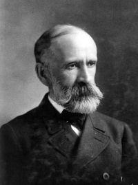 Israel C. Russell,
North America
Israel C. Russell,
North America
“ The facts, so far as known, appear to show that we have here what geologists term a fault, the north or landward side of which has been raised at least 5,000 feet in very modern times, but, so far as we can judge, without disturbing the seaward border of the break. The coast between Mount Fairweather and Mount St. Elias is by far the boldest, and from a scenic point of view the most impressive, portion of the entire shore-line of North America. The mountains are young and among the highest on the continent. ”
Albert Perry Brigham, Cleveland Abbe, David Hale Newland, Alvin Sydney Johnson, Theophilus F. Rodenbough, Lewis Sayre Van Duzer, Isaac J. Cox, James Wilford Garner, Harry A. Cushing, and others, The New International Encyclopædia…
“ Leaving out for a moment the narrow strip of Atlantic lowland, one may best view the United States as made up of two great uplands, with a broad lowland lying between. The country thus shows the physical plan of North America, for the Appalachian belt rises from the Gulf plains in Alabama and ends northward on the shores of Labrador. The Western uplands or Cordilleras begin virtually at the base of the continent; they rise to a great elevation in Mexico, maintain great heights and gain their greatest width in the Western United States; and thence continue through British America and Alaska. ”
by the United States government, Chapters (2002)
“ It is particularly suitable in areas of complex hydrography containing numerous rocks, shoals, and obstructions dangerous to survey vessels. The technology has developed and matured since the 1970’s, and in some areas of the world up to 50% of the hydrographic surveying is done with lasers. Survey rates of some 65 square km per hour are possible, at about a quarter of the cost of comparable vessel surveys. Data density is variable, ranging down to some 1-2 meters square, and depths from one half to over 70 meters have been successfully surveyed. ”
Chautauqua Institution, The Chautauquan, Vol. 05, February 1885
“ Geometry grew out of the practice of surveying, and now embodies many of the laws and principles of the science. There are several distinct systems of surveying, classed according to the purposes contemplated. It is astronomically employed in determining the figure of the earth by the actual measurement of arcs. A fair knowledge of mathematics and trigonometry is required in what are known as coast surveys. Land surveying is of the plainest kind, and employed in finding the contents of areas, or in dividing large tracts into lots of smaller dimensions. ”
by the United States government, Chapters (2002)
“ Processing Hydrographic Data During processing, echogram data and navigational data are combined with tidal data and vessel/equipment corrections to produce reduced soundings. This reduced data is combined on a plot of the vessel’s actual track with the boat sheet data to produce a smooth sheet. A contour overlay is usually made to test the logic of all the data shown. All anomolous depths are rechecked in either the survey records or in the field. If necessary, sonar data are then overlayed to analyze individual features as related to depths. ”
Related terms
Authors who wrote about “United States Coast and Geodetic Survey”
Arthur Mostyn Field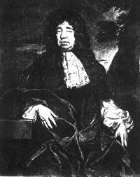 William PettyIsrael C. RussellG. R. Putnam
 Ellen Churchill SempleHenry Cruse MurphyHermann Joseph Klein
 Joseph JacobsAlbert Perry Brigham, Cleveland Abbe…Baron George Anson Anson
 Jules Verne
 Thomas Jefferson
 Edward Shepherd CreasyCharles Patrick DalyHugo BlackStephen Johnson FieldAlfred Thayer MahanVariousby the United States governmentJohn Marshall Harlan II