Sill (geology)

Definition and stakes

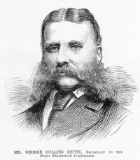
Portrait of Archibald Geikie Archibald Geikie,  The Ancient Volcanoes of Great Britain… (1897)

“ The intrusive character of the Sill, maintained by some of these writers, was finally established by the mapping of the Geological Survey, and was discussed and illustrated by Messrs. W. Topley and G. A. Lebour in a paper in the 33rd volume of the Quart. Journ. Geol. Soc. (1877) , in which references to the earlier observers will be found. See also Prof. Lebour's Outlines of the Geology of Northumberland, 2nd edit. (1886) , p. 92. The petrography of the Whin Sill is fully treated by Mr. Teall in Quart. Journ. Geol. Soc. ”

Source: Gutenberg

Political and commercial geology and the world's mineral resources (1920)

“ Long periods of erosion then planed down the region until all that is left of the sill occupies a synclinal basin nearly 40 miles long and 10 to 15 miles wide. All of the rocks involved are of pre-Cambrian age.
The laccolithic sheet is approximately 10,000 feet thick. It differentiated on cooling into two kinds of rock—micropegmatite, a rock of the granite group, now forming the upper part of the sill, and norite, a gabbro rock, the lower part.
”
Source: Gutenberg

Portrait of Sir Charles Lyell Sir Charles Lyell,  The Student's Elements of Geology

“ In parts of the globe still more remote from Europe the Silurian strata have also been recognised, as in South America, Australia, and India. In all these regions the facies of the fauna, or the types of organic life, enable us to recognise the contemporaneous origin of the rocks; but the fossil species are distinct, showing that the old notion of a universal diffusion throughout the ”primæval seas” of one uniform specific fauna was quite unfounded, geographical provinces having evidently existed in the oldest as in the most modern times. ”
Source: Gutenberg

Get perspective with Kwize: daily news enlightened by great literature