“ The general phenomena on the two opposing sides of the Atlantic have great resemblance. The Atlantic coast of the United States presents an elliptic curve in its entire extent, with three intermediate and similar curves; the first extending seven hundred miles from Cape Florida to Cape Hatteras, the second from Cape Hatteras five hundred miles to the outer capes of Massachusetts, and the third formed by the coasts of Massachusetts, New Hampshire and Maine. Opposite to the United States, the Atlantic admits soundings in every place near the shores, always deepening very gradually. ”
Mid-Atlantic states
Definition and stakes
The theme of “Mid-Atlantic states” has been addressed by authors such as Thomas Jefferson, George Ticknor Curtis, Israel C. Russell, Albert Perry Brigham, Cleveland Abbe, David Hale Newland, Alvin Sydney Johnson, Theophilus F. Rodenbough, Lewis Sayre Van Duzer, Isaac J. Cox, James Wilford Garner, Harry A. Cushing, and others and Walt Whitman. It is often associated with terms like ocean, river, Virginia, Florida and new.
Quotes about “Mid-Atlantic states”
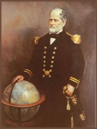 Matthew Fontaine Maury,
Maury's New Elements of Geography for Primary and Intermediate Classes
(1907)
“ Middle Atlantic States.—Leaving New England, let us visit the Middle Atlantic states. All of them except two lie along the Atlantic coast, and are between the New England states on one side and the Southern states on the other. Hence they are called Middle Atlantic. These states are New York, New Jersey, Pennsylvania, De1aware, Maryland, Virginia, and West Virginia. New York and Pennsylvania are the most populous states of the Union and are also first in manufactures. ”
George Ticknor Curtis, History of the Origin, Formation…
“ Nature had marked America for a great commercial nation. The sweep of the Atlantic coast, from the Bay of Fundy to the Gulf of Florida, comprehending twenty degrees of latitude, broken into capacious bays and convenient harbors, and receiving the inward flow of the sea into great navigable rivers that stretched far into the interior, presented an access to the ocean not surpassed by that of any large portion of the globe. ”





Related terms
Authors who wrote about “Mid-Atlantic states”
 Thomas JeffersonGeorge Ticknor Curtis
 Israel C. RussellAlbert Perry Brigham, Cleveland Abbe…
 Walt WhitmanJames Monroe
 Elisha Benjamin AndrewsMartin Van BurenHenry Gannett, Ernest Ingersoll…
 Carl SchurzMatthew Fontaine MauryF.A.S. M.A. Robert E. AndersonVarious
 Frederick Jackson Turner
 Archer Butler Hulbert
 Mark Twain
 Sir William Howard RussellJohn MoodyUnited States. Congress
 Chester A. Arthur
