“ The New Orleans and Teche River canal is a projected navigation of one hundred miles, from a point on the Mississippi, to the waters which unite with the Teche river, at Berwick’s bay. ‘The spirit of enterprise,’ says Mr. Smith, ‘has been displayed on a scale commensurate with the extensive territory of the United States. With the exception of Great Britain and Holland, no country on the face of the globe contains so many or as extensive canals as this republic ”
Teche River
Definition and stakes
The theme of “Teche River” has been addressed by authors such as Joseph Nathan Teal, J. Stephen Jeans, John Charles Frémont, William Denison Lyman and Hermann Hesse. It is often associated with terms like lake, dam, flood, water and canal.
Quotes about “Teche River”
 Charles Dudley Warner,
Studies in the South and West, with Comments on Canada
“ Neither on the Teche nor the Atchafalaya, nor on the great plain near the Mississippi, fit for amphibious creatures, where one standing on the level wonders to sec the wheels of the vast river steamers above him, apparently without cause, revolving, is there any lack of the picturesque. ”
J. D. Love, Creation of the Teton Landscape…
“ Postglacial faulting and tilting along the southern margin of Grand Teton National Park diverted drainage systems (such as Flat Creek, southwest of the Flat Creek fault on the south edge of the geologic map) , raised hills, dropped valleys, and made steep slopes unstable. Flood-control engineers wage a never-ending struggle to keep the Snake River from shifting to the west side of Jackson Hole as the valley tilts westward in response to movement along the Teton fault. ”
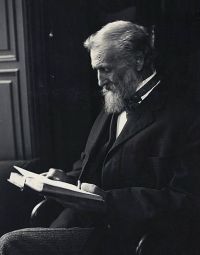 John Muir,
Travels in Alaska
(1915)
“ Making our way through the crowded bergs to the extreme head of the fiord, we entered the mouth of the river, but were soon compelled to turn back on account of the strength of the current. The Taku River is a large stream, nearly a mile wide at the mouth, and, like the Stickeen, Chilcat, and Chilcoot, draws its sources from far inland, crossing the mountain-chain from the interior through a majestic cañon, and draining a multitude of glaciers on its way. ”
Various, Scientific American Supplement…
“ In order to augment its water supply, the North Bloomfield Gravel Mining Company desired to conduct water from a stream known as Texas Creek, in Nevada County, California, across the Big Cañon branch of the South Yuba River into the main Bloomfield flume or aqueduct, which was located on the side of Big Cañon Creek, at a vertical elevation of 620 feet above the bed of the latter stream. The quantity of water to be carried was about 32 cubic feet a second (1,250 miner's inches) , which could be diverted from Texas Creek at a point 480 feet vertical above the Bloomfield flume. ”
Various, The Rivers of Great Britain, Descriptive…
“ Here the Tees, in a succession of violent cascades, makes a descent, as we have seen, of two hundred feet. At High Force it falls by only seventy-five feet; but, whereas the lonelier cataract is a long and broken slope, the water at High Force falls with plummet-like directness, in a vast broad sheet when the river is in flood, in two straight white columns when the floods are subsidin [Pg 200] g, and in a single glittering fall when the river is at its normal height. Here the contrast between the Yorkshire and the Durham side of the Tees first makes itself decisively felt. ”
Ellen H. Walworth, The Life and Times of Kateri Tekakwitha…
“ Through this region one can travel almost in a straight line of open country from Amsterdam on the Mohawk to Jessup's Landing on the Hudson. There the river is fordable, just above Palmer's Falls and below the old scow-ferry. A well-worn trail followed the eastern bank of the river from there to Luzerne, and then turned northeast, through a beautiful valley, to the mountainous shores of Lake George. Somewhere on this direct route across the country, Tekakwitha's uncle overtook one of the two Indians who were escorting her to Canada. Apparently this Indian was engaged in hunting. ”
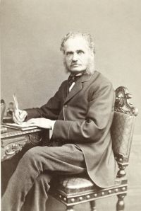 Henry Walter Bates,
The Naturalist on the River Amazons
“ The only tribe known to live on its banks are the Catauishís, a people who perforate their lips all round, and wear rows of slender sticks in the holes: their territory lies between the Purús and the Juruá, embracing both shores of the Teffé. A large, navigable stream, the Bararuá, enters the lake from the west, about thirty miles above Ega; the breadth of the lake is much contracted a little below the mouth of this tributary, but it again expands further south, and terminates abruptly where the Teffé proper, a narrow river with a strong current, forms its head water. ”
 George Wharton James,
The Lake of the Sky
“ Probably more than a hundred affluents of various capacities, deriving their waters from the amphitheater of snow-clad mountains which rise on all sides from 3000 to 4000 feet above its surface, contribute their quota to supply this Lake. The largest of these affluents is the Upper Truckee River, which falls into its southern extremity. The only outlet to the Lake is the Truckee River, which carries the surplus waters from a point on its northwestern shore out through a magnificent mountain gorge, thence northeast, through the arid plains of Nevada, into Pyramid Lake. ”
J. D. Love, Creation of the Teton Landscape…
“ Other lakes formed in response to similar crustal movements in nearby places. One such lake, Grand Valley Lake (fig. 49) , formed about 25 miles southwest of Teewinot Lake; both contained sediments with nearly the same thickness, composition, appearance, age, and fossils. Although these two lakes are on opposite sides of the Snake River Range, the ancestral Snake River apparently flowed through a canyon previously cut across the range and provided a direct connection between them.Development of mammalsThe Cenozoic Era is known as the “Age of Mammals.” ”
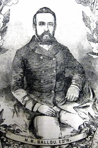 Maturin M. Ballou,
Under the Southern Cross
“ But the truth is that it forms a watercourse dependent at present upon floods, admitting of navigation for hundreds of miles at certain seasons, and at others being as dry as the Arno at Florence or the Manzanares at Madrid. By a series of dams and canals this river might be navigable all the year round. The same remark applies to several of its tributaries, and to rivers generally running toward the inland centres [Pg 236] and flowing into the Murray. The governments of the several colonies have long realized the importance and the necessity of a grand and comprehensive system of irrigation. ”
J. Stephen Jeans, Waterways and Water Transport in Different Countries
“ They are as vital to our commerce and industry as any matter now dealt with by the State, affecting our material well-being, and they are every year increasing in extent and importance. As regards the principal rivers—the Mersey, the Tyne, the Tees, the Clyde, and the Wear especially—they are now controlled in accordance with the recommendation made by the Duke of Richmond’s Select Committee, that “each catchment area should be placed under a single body of conservators, who should be responsible for maintaining the river, from its source to its outfall, in an efficient state.” ”
 William Denison Lyman,
The Columbia River: Its History…
“ Like all travellers to Lake Chelan, we must make a journey to the head of the lake, to the Stehekin River, and to Rainbow Falls. The view up the cañon of the Stehekin is the crowning glory of this panorama of sublimities. A forest of almost tropical luxuriance covers the morass through which the impetuous river makes its way. On either side tower the cañon walls, capped with snow. ”
Mrs. Cecil Clementi, Through British Guiana to the summit of Roraima
“ Above Tukeit the river is a series of racing cataracts, curiously broken by deep, still pools, where the main current would appear to flow beneath the surface. It is, of course, an entirely unnavigable piece of water, and to pursue the valley on foot to the base of the mighty Kaietuk precipice is an enterprise of extreme difficulty, not to say danger. Masses of giant boulders make progress all but impossible ”
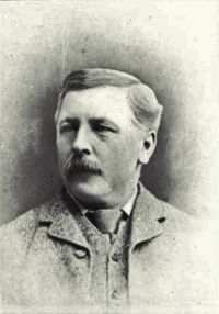 Charles Mair,
Through the Mackenzie Basin
“ Thence the vast stream sweeps boldly into the south, and with a rush discharges down the rapids, and straight over the line of precipice, in a vast tumultuous greyish-drab torrent which speedily emerges into comparatively still water below. The rock here is an exceedingly hard, mottled limestone, resembling the stone at St. Andrew's Rapids on Red River. Where exposed it is pitted or bitten into by the endless action of wind and water, and lies in thick layers, forming an irregular dyke all along the shore, over the surface of which passes the portage, some forty yards in length. ”
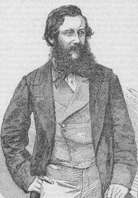 John Hanning Speke,
What Led to the Discovery of the Source of the Nile
“ Both of these rivers rise in high mountains on the coast-range, at about 10° north latitude, but on opposite sides of the continent. They are considered large rivers, but only in consequence of their great floodings, when the sun, in his northern declination, brings the rains over the seats of their birthplaces; for when the sun is in the south they shrink so low that the waters of the Blue river would never have power to reach the sea were they not assisted by the perennial stream of the White Nile. ”
G. Basil Barham, Legend Land, Vol. 1
“ Llyn Tegid is the old name for Bala Lake; it means the lake of beauty, and Bala well deserves that title. Its shores are verdant and beautifully wooded, commanding in many places magnificent distant views of the mountains which encircle it only a few miles [51] away. Its waters teem with fish; trout up to fourteen pounds and pike twice as big have been caught there—but the flyfisher must not expect always such giants. There is salmon-fishing to be had in the Treweryn river in September. In the neighbourhood are places of wonderful beauty. ”
 Watkin Tench,
A Complete Account of the Settlement at Port Jackson
“ At the time we started the tide was flowing up the river, a decisive proof that we were below Richmond Hill. We had continued our march but a short time when we were again stopped by a creek, which baffled all our endeavours to cross it, and seemed to predict that the object of our attainment, though but a very few miles distant, would take us yet a considerable time to reach, which threw a damp on our hopes. We traced the creek until four o'clock, when we halted for the night. The country, on both sides, we thought in general unpromising ”
 Thomas Greenhill,
ΝΕΚΡΟΚΗΔΕΙΑ; Or, the Art of Embalming…
“ A little farther, turning towards the East, it receives two other considerable Streams call’d Kelti and Branti: Near this Place is the first fall of the River; not much farther running towards the East, it enters the Lake of the Abyssins, 130nam’d Bahr Dembea, or the Sea of Dembea. When it has pass’d through this Lake, without mingling with its Waters, it receives many other great Rivers, and chiefly the River Tekeze near Egypt. So soon as Nile is out of the Lake Dembea, it turns to the South-East, leaving on the left the Kingdoms of Beg-amidr, Amhara and Voleca ”
 Theodore Dreiser,
A Hoosier holiday
(1916)
“ We went out past an old bridge to the northeast of the town (scarcely a half mile out) and found to my astonishment that the stream it once spanned—the Tippecanoe, if you please—and that once drained Centre and 324Pike Lakes, was now no more. There was only a new stone culvert here, not the old iron and plank wagon bridge of my day—and no water underneath it at all, only a seepy muck, overgrown with marsh grass!! The whole river, a clear sandy-bottomed stream, was now gone—due to the recession of the lake, I suppose. ”
J. Stephen Jeans, Waterways and Water Transport in Different Countries
“ The improvements that have been carried out for the purpose of opening up the navigation of the river Tees, although less considerable than those carried out for some of the larger rivers of Great Britain, are yet entitled to take rank as among the most notable river engineering achievements of the century. ”
Thomas Teakle, The Spirit Lake Massacre
“ Here and at other points in the vicinity he remained a few years, according to all accounts, and bided his time in true frontier style. In the autumn of 1853 he and his stepson passed through Fort Dodge on their way to [Pg 34] settle at a new location. In early November he selected a site for his cabin about thirty miles north of Fort Dodge, in Humboldt County, at a point where a small creek joins the Des Moines River. This creek has since been named Lott’s Creek in honor of the first white settler in that vicinity. [72] With three barrels of bad whiskey, he re-opened trade with the Indians. ”
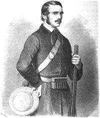 Charles John Andersson,
Lake Ngami
(1861)
“ The Lake is fed by the Teoge at its northwest extremity. The river never, perhaps, much exceeds forty yards; but it is deep, and, when at its greatest height, contains a large volume of water. Its annual overflow takes place in June, July, and August, and sometimes even later. The source of the Teoge is as yet unknown, but is supposed to be very distant. It may probably have its rise on the same high table-land as the Quanza, and other streams of importance. ”
Arthur J. Hayes, The source of the Blue Nile (1905)
“ The banks of the river are steep, and the bed is stony. The water, at that season of the year, was almost clear. But during the rains, when the stream is in flood, it brings down vast quantities of the deposits of the white ants and [165] other detritus. The flat island of Dek has been formed by siltage of alluvial soil thus brought, and it is matter in solution which renders the course of the Abai traceable in Lake Tsana. ”
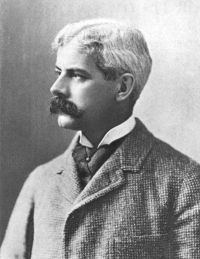 John C. Van Dyke,
The desert
(1901)
“ The descent from the Divide to the Colorado River is quite steep. The flood of waters rushes down the steps of the mesas and over the bare ground with terrific force. It quickly cuts channels in the low places down which are hurled sand, gravel, and bowlders. The cutting of the channel during the heavy rains is something extraordinary, partly because the stream has great volume and fall, and partly because the channel-bed is usually of soft rock and easily cut. In a few dozen years the arroyo of a mesa that carries off the water from the mountain-range has cut a river-bed many feet deep ”
Alexander Jardine, Narrative of the Overland Expedition of the Messrs…
“ December 20.—The river was still followed down to-day, the party keeping about four miles from it, to avoid its scrubs and ana-branches. At between 7 or 8 miles, a stream about 100 yards wide, coming from the eastward, caused them to halt until a road was cut through the thick vine scrub that fringed its banks. Four miles further on they camped at a small lagoon close to the bank of the river, at which point it is about 100 yards wide, deep, and too salt for drinking, being affected by the tide. The country travelled over was box, and tea-tree, melon-hole flats, shewing very high flood marks. ”
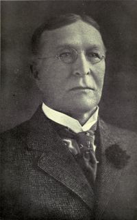 Joseph Nathan Teal,
The Mighty River of the West
(1912)
“ Here for a distance of about 12 miles the river is not navigable on account of rapids and falls. A canal 81⁄2 miles in length is being constructed by the United States along the Oregon shore. Above the Celilo Falls the river for a distance of several hundred miles has a navigable low-water depth of about 4 feet. The only improvement in progress is that of removing the most dangerous rocks in the channels. Navigation above Celilo Falls is now limited to the stretch below Priest Rapids, on the Columbia, a distance of about 170 miles, and to Lewiston on the Snake River. ”
Paul B. Du Chaillu, Stories of the Gorilla Country…
“ We lighted our fires; and, having cooked and eaten our fish, which were delicious, we prepared for a night's rest by spreading mats upon the sand. It was terribly cold; for we were not sheltered from the wind, which went right through my blanket.Not far from Fetich Point is the river Tetica, one of the tributaries of the Nazareth river. The Nazareth falls into the bay, through a tangled, dreary, and poisonous track of back country, consisting of mangrove swamps, like those I have described on the Monda river, and where, I daresay, no animals, except serpents, are to be found. ”
Yat-sen Sun, The International Development of China
“ First, the prevention of floods and second, the improvement for navigation. In dealing with the first aspect nothing could be better than deepening the river by dredging. In the improvement of the Canton Approach and Harbor and also of the Canton Delta, we have to cut a deep channel right from the deep sea up to Sainam. In the improvement of the lower part of the North River, we have simply to continue the cutting process higher up until we have a deep channel, say 15 to 20 feet as far as the Tsingyuen Gorge, either by artificial or natural means. ”
Related terms
Authors who wrote about “Teche River”
Joseph Nathan TealJ. Stephen Jeans John Charles FrémontWilliam Denison Lyman
 Hermann Hesse
 Augustus Charles Gregory
 Richard TaylorVariousJ. D. LoveJohn Muir
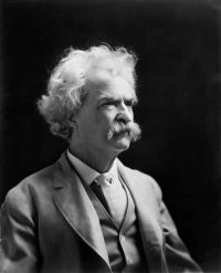 Mark Twain
 Rabindranath TagoreHenry Walter Bates
 Joseph Conrad
 John Wesley Powell
 Woodes Rogers
 Henry David Thoreau
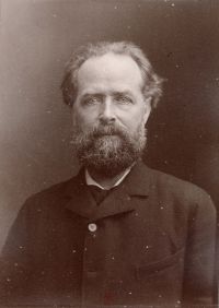 Élisée ReclusWilliam E. Garstin
 Jerome K. Jerome
