“ JUMNA, n.p. The name of a famous river in India which runs by Delhi and Agra. Skt. Yamunā, Hind. Jamunā and Jamnā, the Διαμούνα of Ptolemy, the Ἰωβαρής of Arrian, the Jomanes of Pliny. The spelling of Ptolemy almost exactly expresses the modern Hind. form Jamunā. The name Jamunā is also applied to what was in the 18th century, an unimportant branch of the Brahmaputra R. which connected it with the Ganges, but which has now for many years been the main channel of the former great river. ”
Jamuna River
Definition and stakes
The theme of “Jamuna River” has been addressed by authors such as W. W. W. Humbley, Hermann Hesse, Andrew A. Anderson, Charles Sturt and Sir Alexander Burnes. It is often associated with terms like lake, Ganges, canal, dam and India.
Quotes about “Jamuna River”
“ The appearance of the Jumna, even in the dry season, strikes one as very imposing, with its enormous span from shore to shore, shut in by high, shelving, sandy banks, its then placid waters a clear bright blue. What must be the effect in the freshes, when its surging waters rush resistlessly past, and its banks are hidden by a suddenly formed expanse of water more resembling sea than river? ”
Various, Encyclopaedia Britannica, 11th Edition…
“ The tract to the north-east of that stream is rich and fertile, being watered by the Cawnpore and Etawah branches of the Ganges canal, and other important works. The south-western region has the same natural advantages, but possesses no great irrigation system, and is consequently less fruitful than the opposite slopes. Near the banks of the Jumna, the plain descends into the river valley by a series of wild ravines and terraces, inhabited only by a scattered race of hereditary herdsmen. ”
A. Hamilton, Afghanistan (1906)
“ This river, rising in the Taimani country, flows past Farah and Lash into the Hamun at its north-west angle, after a southerly course 200 miles in length. Its volume varies with the seasons. The water is usually clear and not quite drinkable for, after the main stream has been exhausted by the fields, the pools which remain in its deeper parts quickly become stagnant. In the spring it is a wide, deep river, always with sufficient water for irrigation in its course: even when nearly dry water is to be found by digging a foot into the river-bed. ”
James Herbert Walker, The Johnstown Horror!!!
“ It rumbles and threatens as if confident of an access of strength that laughs at resistance. From far up the hillside comes a sound, at first soft and soothing as the fountains of Lindaraxa, then rolling onward it takes the voluminous quaver of a distant waterfall. Louder and louder, deeper and deeper, nearer and nearer comes an awful crashing and roaring, till its echoes rebound from the crags of the Alleghanies like peals of thunder and boom of cannon.On, on, down the steep valley trumpets the torrent into the river at Jamestown. ”
John Henry Goldfrap, The Boy Scouts at the Panama Canal
“ Any weakness in the Gatun Dam would ruin the whole project. You can see, of course, why this is so, because the water in that Gatun Lake will be relied upon to fill the locks which will raise vessels up or down.” [179] “But suppose the Chagres River cuts up ugly, as you said it does sometimes?” asked Merritt.“Well,” said Rob, “I heard Mr. Mainwaring say that the great lake will be so big that a flood would affect its level no more than a cup of water poured into a bath tub. The river will merely serve to keep the lake filled and supply the water needed to work the locks.” ”
prince de François-Ferdinand-Philippe-Louis-Marie d'Orléans Joinville, Memoirs (Vieux Souvenirs) of the Prince de Joinville
“ We soon reached the mouth of the Gambia River, and, entering it through a labyrinth of sandbanks, we saw a wide stream with flat shores covered with mangrove swamps, behind which aquatic form of vegetation huge trees rose, fantastically tall, and in all the splendour of their tropical growth. All the rivers of the West African coast present this identically same appearance. ”
James P. Boyd, Stanley in Africa
“ If Ngami rises by means of its inflow, the current is down the Cubango toward the “Salt Pans.” If however the “Pans” overflow, by means of their other tributaries, the current is up the Cubango toward Lake Ngami. So that among the other natural wonders of Africa we have not only a system of great rivers pouring themselves into an inland sea with no outlet except the clouds, but also a great river actually flowing two ways for a distance of over a hundred miles, as the one or the other lake on its course happens to be fullest. ”
1911 Encyclopædia Britannica, Volume 17… (1911)
“ On the south-western boundary the Jumna flows in a deep alluvial bed, sometimes sweeping close to the high banks which overhang its valley, and elsewhere leaving room for a narrow strip of fertile soil between the river and the upland plain. ”
J. McF. Gaston, Hunting a home in Brazil (1867)
“ A change, however, in the land, seems to commence near this place, and it assumes here very much the aspect of red clay, but in some parts the sandy soil predominating, and all lying very irregular, except immediately upon the streams.I was impressed with the adaptation of the Jundiahi river, a small stream which runs near our inn, for the location of machinery of limited water-power; and when the railroad reaches this place a good mill or cotton ginning establishment would be likely to prove very advantageous on this river. ”
1911 Encyclopædia Britannica (1911)
“ The weir across the Jumna was the first attempted in Upper India upon a foundation of fine sand; it is about 800 yds. long, and rises 7 ft. above the summer level of the river. From Okla the canal follows the high land between the Khari-nadi and the Jumna, and finally joins the Banganga river about 20 m. ”
Harry Clow Boardman, The Panama Canal
“ The majority of the board, 8 to 5, opposed the idea of a dam and locks at Gatun on two grounds: first, that the introduction of locks in a treatment of the question was objectionable from many points of view; and, second, that the maintenance of a summit by means of an earth dam of immense magnitude to control the flood waters of this river introduced an element of great danger since the dam, without sheet piling, was proposed to be founded on the alluvial-filled gorges of the Chagres River, where the depth at one point extended 258 feet below the level of the sea. ”
George Francis White, Views in India, chiefly among the Himalaya Mountains (1838)
“ These fellows push out from the rock whenever the state of the water will permit, and follow the voyagers with their importunities. But when the river is full, and the current, strengthened by the melting of the snow, comes down in one sweeping flood, there is no loitering under the rock of Janghera, and a vessel sailing up with a strong wind, against this tide, makes rather a perilous navigation as it stems the rapid waters. In going down the Ganges at such a period, we pass the rock like an arrow shot from a bow, only catching a transient glance of its picturesque beauty ”
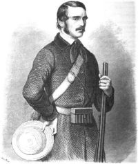 Charles John Andersson,
Lake Ngami
(1861)
Charles John Andersson,
Lake Ngami
(1861)
“ Both banks of this peculiar water-course were hemmed in by one vast thorn-jungle, which seemed to defy the passage of man or beast. It was doubly fortunate, therefore, that we met this river, as its sides served as a good and open road, while a plentiful supply of water was afforded by the occasional pools. It was here, at last, that we arrived at some Damara villages, on the fifth day after leaving Otjironjuba. At first the natives tried to run away; but we captured a few women, which soon induced the men to return. These people had never before seen a white man ”
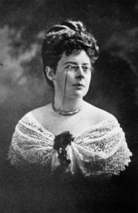 Beatrice Grimshaw,
In the Strange South Seas
Beatrice Grimshaw,
In the Strange South Seas
“ In reality it is the source we have reached; here the whole Hamurana stream springs full-grown from the earth. A great rift in the bed of the glassy river is visible, where the water wells up under our keel in wavering masses of amber, aquamarine, and deep blue, shot with glancing arrows of prismatic light. ”
Jules Joubert, Shavings & Scrapes from many parts
“ A single one of its many tributaries—the Jumna—has an independent existence of 860 miles, with a catchment basin of 118,000 square miles, and starts from an elevation at its source of 10,849 feet above sea-level.As a factor in the commercial welfare of India the Ganges plays an important part. Until the opening of the railways its waters formed the almost sole channel of traffic between Upper India and the sea-board. The products not only of the river plains, but even those of the central provinces, were all brought by this route into Calcutta. ”
William Charles Benett, Gazetteer of the Province of Oudh Vol-2 -- H. to M. (1877)
“ There are no mountains. Drainage.—The drainage of the country is carried on by the Gumti and Sai rivers, which in their turn receive small tributary streams. The chief of these is the Bạita, a small perennial stream, which, rising in the Hardoi district, passes through the Malihabad pargana in a south-easterly direction, and falls into the Gumti at a point on its right bank near Kánkrábad. "The Loni, another stream having its source in the Mohanlalganj pargana, passes through it, and joins the river near Salempur on its right bank. ”
Various, Encyclopaedia Britannica, 11th Edition…
“ The smaller rivers of eastern Java are, however, much in the condition of those of western Java. They serve less as waterways than as reservoirs for the irrigation of the fertile plains through which they flow.The north coast of Java presents everywhere a low strand covered with nipa or mangrove, morasses and fishponds, sandy stretches and low dunes, shifting river-mouths and coast-lines, ports and roads, demanding continual attention and regulation. The south coast is of a different make. The dunes of Banyumas, Bagelen, and Jokjakarta, ranged in three ridges, rising to 50 ft. ”
Various, Encyclopaedia Britannica, 11th Edition…
“ Beginning with the Punjab, the province in which most progress has been made, the great Sutlej canal, which irrigates the country to the left of that river, was opened in 1882, and the Western Jumna canal (perhaps the oldest in India) was extended into the dry Hissar and Sirsa districts, and generally improved so as to increase by nearly 50% its area of irrigation between 1878 and 1897. Perhaps this is as much as can well be done with the water at command for the country between the Sutlej and the Jumna, and it is enough to secure it for ever from famine. ”
Harry Clow Boardman, The Panama Canal
“ At Gatun a dam one and one-half miles long and 115 feet high will impound the waters of the Chagres river in a lake, the normal level of which will be 85 feet above mean sea-level, A flight of three twin locks, each 1,000 feet long, 110 feet wide, and allowing for 411⁄3 feet of water over the sills, will raise vessels from sea-level to the lake, or lower them from the lake to the sea-level channel. From Gatun navigation will be through the lake in a channel from 1,000 feet to 500 feet wide for a distance of 23.59 miles to Bas Obispo where Culebra cut begins. ”
1911 Encyclopædia Britannica (1911)
“ The descent to the lower district is marked by the Barraconda rapids, formed by a ledge of rock stretching across the river. Between 30 and 50 m. above the falls the Gambia is joined by two considerable affluents, the Nieriko from the north and the Kuluntu or Grey river from the south. From the Barraconda rapids to the Atlantic the Gambia has a course of about 350 m. Throughout this distance the waters are tidal, and the river is navigable all the year round by boats drawing 6 ft. ”
H. A. Bryden, From Veldt Camp Fires
“ The few hunters, traders, and Trek Boers who cross the dreaded Thirstland of the Northern Kalahari, and, upon their long and trying journey towards Lake Ngami, strike the Lake River (marked upon the maps Zouga or Botletli River) , well know the pleasant outspan at Masinya’s Kraal. Masinya’s is a small village of Bakurutse natives, planted a mile or so from the southern bank of the Lake River. Between the kraal and the river, amid a thin grove of spreading giraffe-acacia trees, set upon a little islet of rising ground, lies the outspan where travellers bound to and from Ngami usually halt. ”
G. Harvey Ralphson, Boy Scouts in the Canal Zone; Or…
“ Now do you see what the Gatun dam is for?”“Sure. To flood that basin and turn the Chagres into a lake,” cried Jimmie. 145“That is just what will be done. The Panama canal will be a lake most of the way. The locks will float the vessels up to the lake and down to the canal again. The hills, and forests, and farms of the basin will be under water.”“And the mines,” Jimmie said, thinking of the talk he had had with Peter concerning the emerald mines. “The lake will flood them, too.” ”
E. S. Bellasis, River and Canal Engineering, the characteristics of open flowing streams…
“ In mountainous districts landslips sometimes occur and block the valley of a stream which then forms a lake. The water gradually rises and eventually flows over the dam and sweeps it away causing a flood, which is of great suddenness and height but decreases very quickly in height as it travels down the valley. In a case which occurred in the Himalayas in 1888 the inhabitants of the valleys, from the dam to the point where the river debouches from the hills, were compelled by Government to vacate all habitations below the probable level of the flood, and no loss of life occurred. ”
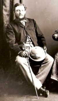 Henry Walter Bellew,
From the Indus to the Tigris
(1874)
Henry Walter Bellew,
From the Indus to the Tigris
(1874)
“ Beyond this we entered on the Bandi Tymúr, a long strip of villages and cultivation extending for twelve miles or so along the right bank of the river, which here flows over a wide pebbly channel interspersed with patches of [163] dwarf tamarisk jangal. The soil is everywhere gravelly and charged with salines, which here and there form extensive encrustations on the surface. Several kárez streams, brought from the undulating tract of Kháki Chanpán to the north, cross the road at intervals, and a succession of irrigation canals led off from the river intersect the country on either side. ”
Farnham Bishop, Panama, past and present (1916)
“ Everywhere trim little concrete lighthouses, looking strange enough in the jungle, are being built, or, rather, cast in one piece, on wooded hilltops that will soon be islands. Already the yellow water is rapidly backing up, as the dam and the spillway gates are being raised. You can mark the spread of the lake by the gray of the dying, drowned-out trees against the green of the living jungle. Only in the channel and the anchorage basin has Gatun Lake been cleared of timber, and the greater part of it will be a mass of stumps and snags. ”
Andrew A. Anderson, Twenty-Five Years in a Waggon in South Africa…
“ Great Namaqualand terminates about this point, and Damaraland begins.From the sea-coast for many miles inland the country is barren and poor; as the highlands are reached vegetation improves. The Desert of Tans extends a long distance inland, nearly to Mitchell’s Mount, which is a lofty hill of 6000 feet, commanding most extensive views in every direction. On the tributaries of the Great Fish river, and the river itself, most of the natives live in small wherfs, at the mission stations belonging to the Rhenish Mission Society, Bethany, Bethesda, Reheboth, and others. ”
E. S. Bellasis, River and Canal Engineering, the characteristics of open flowing streams…
“ In the Punjab the growth of all kinds of jungle is encouraged. It binds the soil together and protects it from the wash of waves and from winds which blow away sand and dust, and so wear the embankment slowly away.In embanking a long reach of a river it is convenient to begin from the upstream end, because otherwise floods may get behind the finished part of the embankment and, becoming impounded in a “pocket” formed by the embankment and high land, rise to an abnormal height and, unless gaps in the embankment have been left or are subsequently made, cause breaches. ”
Various, Lippincott's Magazine of Popular Literature and Science…
“ Next day we rise 2000 feet higher, and redescend 6500 feet to the banks of the Kischanganga, the chief affluent of the Jhelam, running mostly parallel to the course of the latter stream. Then we undulate—if so soft a term be applicable to a route so sharply, abruptly and irregularly serrate—along the spurs which border the river, now in the forest and now on a bleak plateau where careful irrigation avails to grow nothing less hardy than millet, peas and buckwheat. ”
George Francis White, Views in India, chiefly among the Himalaya Mountains (1838)
“ Crossing the snowy bed whence the water emerges at Jumnootree, is a work of some difficulty, and when accomplished we find that the infant river is divided into three streams, each forming a separate waterfall, and flowing over steep green hills. The lower of these are surmountable, but with great difficulty and some danger, as the stones are loose, and slip from under the feet: in process of time, however, we may look forward to such an improvement in the roads of these hills as will allow the traveller to reach the utmost extent which human means can render possible. ”
Related terms
Authors who wrote about “Jamuna River”
W. W. W. Humbley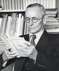 Hermann HesseAndrew A. Anderson
 Charles SturtSir Alexander BurnesThomas ThomsonVariousGeorge Francis White
 Joseph ConradE. S. BellasisJames Herbert WalkerA. Hamilton
 John Wesley Powell
 John MuirHarry Clow Boardman
 Jerome K. Jerome
 Rabindranath TagoreJ. McF. GastonCharles John Andersson
 John Hanning Speke
Hermann HesseAndrew A. AndersonCharles SturtSir Alexander BurnesThomas ThomsonVariousGeorge Francis WhiteJoseph ConradE. S. BellasisJames Herbert WalkerA. HamiltonJohn Wesley PowellJohn MuirHarry Clow BoardmanJerome K. JeromeRabindranath TagoreJ. McF. GastonCharles John AnderssonJohn Hanning Speke