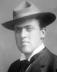
“ The Canal Zone is a strip of land ten miles wide running across the Isthmus—really an American colony, you know, for we govern it, police it, and all that. As for the work itself, well, the fellows at the two ends of the Canal are dredging night and day to complete their part, the lock-builders are laying concrete like mad to get their share done first, the chaps in the big cut are boring through the hills like moles and breaking steam-shovel records every week, while we railroad men take care of the whole shooting-match. ”
Canal Zone
Definition and stakes
The theme of “Canal Zone” has been addressed by authors such as J. Stephen Jeans, John F. Dryden, Hubert Gordon Thompson, Edwin A. Pratt and Charles Shattuck Hill. It is often associated with terms like navigation, lock, river, sea and railway.
Quotes about “Canal Zone”
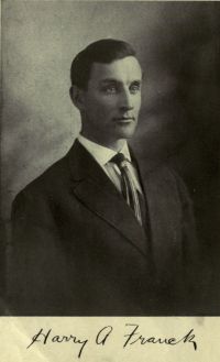 Harry Alverson Franck,
Zone Policeman 88; a close range study of the Panama canal and its workers
“ In other words kind Uncle Sam was about to give me authority to enter every dwelling in the most cosmopolitan and thickly populated district of his Canal Zone, and to put questions to every dweller therein, note-book and pencil in hand; authority to ramble around a month or more in sunshine and jungle—and pay me for the privilege. There are really two methods of seeing the Canal Zone; as an employee or as a guest at the Tivoli, both of them at about five dollars a day—but at opposite ends of the thermometer. ”
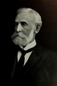 John F. Dryden,
The American Type of Isthmian Canal
“ General Abbot, as a member of the consulting board, had signed the report of the minority in favor of a lock canal. Gen. George W. Davis, United States Army, for a time governor of the Canal Zone and president of the International Board of Consulting Engineers, restated his views and convictions as opposed to the lock-canal type and in favor of the sea-level project. ”
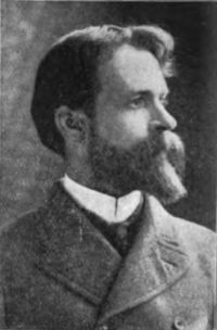 Willis J. Abbot,
Panama and the Canal in Picture and Prose
“ The Canal Zone is an outpost of a high civilization in the tropics. It affords object lessons to the neighboring republics of Central America in architecture, sanitation, road building, education, civil government and indeed all the practical arts that go to make a State comfortable and prosperous. ”
Mark Wicks, To Mars via the Moon: An Astronomical Story
“ On the outer zone are extensive residential areas, then a zone of factories and workshops, and beyond that an area often extending for miles, which is covered with cereals and vegetables, fruit trees and nut trees. Outside all is a zone of timber trees. The town and its surroundings, therefore, cover a vast area.The canals radiate in all directions from the outer edge of the wide ring-canal, and all quays, wharves, and warehouses are alongside of these canals. ”
Victor Appleton, The Moving Picture Boys at Panama…
“ One is to build it and let the water in to the foot of the hill, and then to raise vessels over, the crest of the hill, and down the other side to where the canal again starts, by means of inclined planes, or marine railways. The other method is by "locks," as they are called. That is, there are built a series of basins with powerful, water-tight gates dividing them. Boys who live along canals well know how locks work. A boat comes along until it reaches the place where the lock is. It is floated into a basin, or section, of the waterway, and a gate is closed behind it. ”
Fanny Emily Penny, On the Coromandel Coast (1908)
“ In more recent times a great deal of the material that was once carried thus has been diverted to the railway ; but bulky country products such as firewood, palm leaves, cocoanut fibre, and bamboos are still transported by the leisurely barge that is towed and punted between the high banks of the canals and over the glassy water of the Cooum. Appearances are nowhere more deceptive than in the East. The canal looks an ideal stream for the house-boat, but it is hot and stifling. ”
John F. Dryden,
The American Type of Isthmian Canal
“ Our concern is with a matter of fact, and not with a theory. No ship-owner on the Great Lakes considers it a serious hindrance to navigation for vessels to pass through the lock of the "Soo" Canal; no shipper running 1,000-ton barges through the future Erie Canal will have the least apprehension of danger or destruction; no captain navigating a vessel or boat through the proposed deep waterway from the ocean to the Lakes will hesitate to pass through locks with a proposed lift of over forty feet. ”
J. Stephen Jeans, Waterways and Water Transport in Different Countries
“ On many waterways, and especially in countries which have limited railway facilities, like Russia, canals are found as well adapted as railways to all purposes of transport. On the canals of the United States, the canals compete with the railways in carrying wheat and other agricultural produce. On the Aire and Calder canal, the canal boats are adapted to carry, and as a matter of fact do carry, considerable quantities of general merchandise, as well as minerals. ”
Clive Day, A history of commerce (1922)
“ A map of the world shows two narrow strips of land left by nature almost as though with the design of stimulating men to pierce them, the isthmus of Suez and the isthmus of Panama. A canal at either point unites not countries or small seas, but continents and great oceans, and saves thousands of miles in the routes of trade. The American isthmus presents great difficulties to the construction of a canal, but the Suez route runs through a district composed almost entirely of sand, with no elevation above 50 or 60 feet and with considerable parts actually below the level of the sea. ”
Clive Day, A history of commerce (1922)
“ This enormous gain in efficiency, resulting from the avoidance of the slightest difference in level and from the reduction of force wasted in friction, suggested to people in early times the idea of establishing channels for water where none had previously existed, that is, of building canals. Locks, for controlling the flow and level of the water, were invented toward the end of the Middle Ages, and a considerable extent of canals had been constructed on the Continent before the Bridgewater canal, described above, was opened in England. ”
J. Stephen Jeans, Waterways and Water Transport in Different Countries
“ The cost of the undertaking (estimated at 25,000,000l. to 30,000,000l.) , although a large sum, is not deemed to be too much for a great artificial river more than 300 miles long, 18 feet deep, 100 feet wide at the bottom, and having locks 450 feet long and 60 feet wide. These dimensions would enable the canal to float the largest vessels that navigate the great lakes from Lake Erie to the deep waters of the Hudson. ”
The Parochial History of Cornwall…
“ Most river navigations beyond the reach of tides, are impeded by shallows in summer, by floods in winter, by artificial rights of mills, drainages, &c., all of which are avoided by the Grand Junction Canal, which, availing itself of cross valleys, and perforating narrow ridges, has opened an inland navigation from the metropolis 11 to the British Channel, to the Irish Sea, and to the German Ocean. ”
J. Stephen Jeans, Waterways and Water Transport in Different Countries
“ It is true that no canal has been carried, like the Callao, Lima, and Oroya railroad, in Peru, to the height of nearly sixteen thousand feet above the level of the sea. [24] It has, however, on the Languedoc and other canals been found easily feasible to carry a canal to a height of 600 to 1000 ft. above the sea. Canal engineers have not, perhaps, pierced the Alps with a tunnel ten miles in length, as on the Saint-Gothard Railway; but they have carried a tide-water canal from the Mediterranean to the Red Sea, and they have essayed to perform the same feat through the Cordillera. ”
John F. Dryden,
The American Type of Isthmian Canal
“ Engineers of the highest standing at home and abroad have expressed themselves for or against one type or the other, but it is a question upon which no complete agreement is possible. In theory a sea-level canal has unquestionable advantages, but, practically, the elements of cost and time necessary for the construction preclude to-day, as they did in 1894, when the New Canal Company recommenced active operations, the building of a sea-level canal. ”
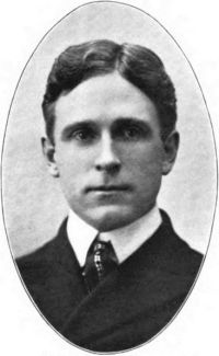 Archer Butler Hulbert,
The Great American Canals (Volume 2…
“ A bridge across the Atlantic or a tunnel underneath it could scarcely provoke more sneers today. Yet the summer of 1817 saw the rows of stakes driven into the ground—over hill and vale, through densest forest and sickliest swamp, from east to west; the outer rows were sixty feet apart and indicated the space to be [Pg 114] grubbed; between these were two other rows forty feet apart which indicated the exact dimensions of the canal; a single row of stakes in the middle marked the exact center of the canal. ”
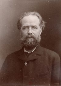 Élisée Reclus,
Africa by Élisée Reclus/Volume 1
(1892)
“ This great highway, a veritable marine strait, which is visited by sharks and cetaceans, and where are now intermingled the various flora and fauna of the Mediterranean and Red Sea, presents dimensions which at the time seemed prodigious, but which are already acknowledged to be inadequate. The canal, which is 98 miles long from sea to sea, and from 200 to 330 feet wide between the banks, has a depth nowhere less than 26 feet, and in some places nearly 28 feet. Dredges are constantly engaged, clearing out the sand and mud, which the wash of passing steamers causes to accumulate on the bottom. ”
Archer Butler Hulbert,
The Great American Canals (Volume 2…
“ Those who laughed at the stakes grew sober when men came on over the route boring with four inch augers into the ground every few rods to a depth of twelve feet; by this means the nature of the soil was tested all along the route and estimates could be made of the cost of the digging; thereupon profiles could be drawn by the engineers. Each of the three great sections of the canal was subdivided into very small sections which were to be let to contractors ”
 Edwin A. Pratt,
A History of Inland Transport and Communication in England…
(1912)
“ It is very doubtful if even Parliament, had it possessed the greatest foresight, could have forced, or have persuaded, the canal companies to construct locks of precisely the same dimensions at elevations of 400, 500 or 600 feet, where water was difficult to get or costly to pump, as on canals more or less on the sea level, and deriving an abundant water supply from mountain streams or navigable rivers. ”
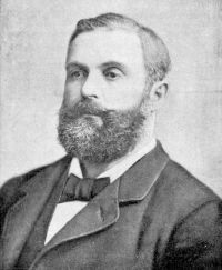 Thomas Wallace Knox,
The Boy Travellers in the Far East…
“ In addition to the cost of carrying water was that of keeping the track clear of sand, which was drifted by the wind exactly as snow is drifted in the Northern States of America, and sometimes the working of the road was suspended for several days by the sand-drifts. The present railway follows the banks of the Maritime Canal as far as Ismailia, and thence it goes along the Fresh-Water Canal, of which I will tell you."The idea of a canal to connect the Mediterranean and Red Seas is by no means a modern one." ”
J. Stephen Jeans, Waterways and Water Transport in Different Countries
“ The large traffic on the Erie Canal, between Lake Erie and the Hudson River, is conducted in barges of 250 tons; the canal has a depth of 7 feet, with a bottom width of 56 feet, and pitched side slopes of 1 to 1·5; and the locks are 110 feet long and 18 feet wide. The Welland and St. Lawrence Canals are on a larger scale, as they provide access to the coast for the large inland lakes of North America, with vessels of 1000 to 1500 tons, and therefore, like the Ghent-Terneuzen Canal, occupy a sort of intermediate position between inland and ship canals. ”
George R. Chatburn, Highways and Highway Transportation
“ There is one class of canals that seems to have held its own, that is ship canals. The great canal and locks at Sault Ste. Marie transfer a vast lake traffic annually from one level to another between Lakes Superior and Huron. Vast quantities of iron-ore are brought in mammoth vessels by this route from docks near the Mesaba mines for the great iron mills at Gary, at Cleveland, at Pittsburgh, and other points. Similar vessels loaded with wheat, oats, and flax from the Northwest grain fields are unloaded at Buffalo for transportation to the seaboard. ”
John F. Dryden,
The American Type of Isthmian Canal
“ They advance a number of specific reasons why a lock canal when completed will for all practical purposes—commercial, military, and naval—be a better canal than a sea-level waterway with a tidal lock, as proposed by the majority members of the Board. ”
The Great Events by Famous Historians…
“ Some of it has been utilized in reclaiming land; much has been carried out to sea and heaped into a break-water three miles long, which runs out from the Panama or southern end of the Canal, and will check a coast-ways current that might, if uncontrolled, silt up the approach. The Canal is a triumph, not of man's hands, but of machinery. ”
H. R. Hill, A Succinct View of the Importance and Practicability of Forming a Ship Canal across the Isthmus of…
“ Although at first sight it may appear to be a work of supererogation, to carry the Canal over that part of the Isthmus which is traversed by navigable rivers, it is by many engineers considered preferable in forming a Canal, to use the rivers in its vicinity only for the purpose of supplying the Canal with water, and not as a continuation of the inland navigation, on account of the variation in the depth of rivers from floods, or other accidents. ”
The New Student's Reference Work (1914)
“ Most engineers are agreed that the ordinary canal can never be made to compete with the railroads in the United States. Now, however, the tremendous growth of the country's commerce has made it absolutely indispensable to improve all our waterways and make new canals. The railroads cannot carry the freight. An unofficial inland waterways commission appointed by the government in March, 1907, has made a careful study of the rivers and canals of the whole country. ”
Hubert Gordon Thompson, The Canal System of England (1904)
“ Individual Enterprise. But although there has been no general or Government scheme for Canal improvement, yet the enterprise of a few individual Companies, such as the Aire and Calder and Weaver Navigations, has shewn that an up-to-date system will command success. Such success is shewn by the Board of Trade returns for 1890, when these navigations, constituting 114 out of a total of 3,935 miles of English waterways, together carried over 10% of the total freight on English Canals, or 3,750,000 tons out of a total of 34,325,000 tons transported on our Canals. ”
J. Stephen Jeans, Waterways and Water Transport in Different Countries
“ The canal is navigated by vessels of 70 tons, and steamers of 45 tons and 25 h.p. The traffic amounts to about 4000 vessels per annum. It was completed in 1868 at a cost of 81,500l.The Kinda Canal rises 171 feet by fifteen locks to a level of 277 feet above the sea. The length of the navigation is 491⁄2 miles, of which 223⁄4 is either artificial canal or trained river. The length of the locks is 90 feet 6 inches, breadth 18 feet 4 inches, and depth over sill 4 feet 101⁄2 inches. The traffic is from 3000 to 4000 vessels per annum. ”
Charles Shattuck Hill, The New International Encyclopædia…
“ The bottom of the channel is always made flat; in soft ground the sides are made sloping, the angle of slope depending upon the stability of the material, being quite steep in firm materials and quite flat in unstable materials; and in rock the sides are made vertical or nearly so. The attempt is always made for the sake of economy of excavation to approach as nearly to a rectangular cross-section as the conditions will permit. When the canal passes through towns the sides are made vertical to save space and provide quays, retaining walls being used in soft ground to form vertical sides. ”
Willis J. Abbot,
Panama and the Canal in Picture and Prose
“ The railroad then crossed upon this dyke to the western side of the Canal and passed through several construction towns and villages, abandoned later when the Canal was filled and the railroad moved to the other side. Tourists with an eye for the spectacular used to stand on this dyke and speculate upon the thrilling sight when a huge blast of dynamite should rend the barrier, and in a mighty wave the waters of Gatun Lake should rush down the broad channel betwixt the eternal hills to make at last the long desired waterway from Orient to Occident. ”
James Croil, Steam Navigation and Its Relation to the Commerce of Canada and the United States
“ The cry for “deeper waterways” has been in the air for many years, but never has it been louder than just now. The first enlargement of the St. Mary’s Falls Canal in 1881, and the subsequent deepening of the channels connecting the Upper Lakes had the effect, almost immediately, of doubling the tonnage of vessels plying the lakes and of producing a corresponding reduction in the rates of freight. ”
 Nathaniel Parker Willis,
American Scenery, Vol. 1 (of 2…
“ VIEW ON THE ERIE CANAL, NEAR LITTLE FALLS. The passage of the Canal, under the lofty bluff which springs at this place from the edge of the Mohawk, is one of the most beautiful of the many beautiful features disclosed to the voyager on this great outlet of the West. No traveller sees a greater variety of fine objects within the same distance than the follower of the Canal from Schenectady to Buffalo; and certainly none sees them with more ease and comfort to himself. The packet-boats are long drawing-rooms, where he dines, sleeps, reads, lolls, or looks out of the window ”
Related terms
Authors who wrote about “Canal Zone”
J. Stephen JeansJohn F. DrydenHubert Gordon ThompsonEdwin A. PrattCharles Shattuck HillArcher Butler Hulbert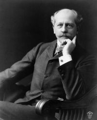 Percival LowellE. S. BellasisHarry Clow BoardmanMark WicksH. R. HillN. E. JonesDuke of Saxe-Weimar-Eisenach Bernhard
 Alfred Francis Blakeney CarpenterGeorge R. ChatburnÉlisée Reclus
 William MaskellWillis J. AbbotClive DayHarry Alverson Franck
John F. DrydenHubert Gordon ThompsonEdwin A. PrattCharles Shattuck HillArcher Butler HulbertPercival LowellE. S. BellasisHarry Clow BoardmanMark WicksH. R. HillN. E. JonesDuke of Saxe-Weimar-Eisenach BernhardAlfred Francis Blakeney CarpenterGeorge R. ChatburnÉlisée ReclusWilliam MaskellWillis J. AbbotClive DayHarry Alverson Franck