“ The Vermilion is a considerable stream, which enters the Illinois from the south, two hundred and sixty miles above the Mississippi. Not far below this river, and two hundred and ten miles above the Mississippi, commences Peoria lake, which is no more than an enlargement of the river, two miles wide on an average, and twenty miles in length. Such is the depth and regularity of the bottom, that it has no perceptible current whatever. It is a beautiful sheet of water, with romantic shores, generally bounded by prairies; and no waters in the world furnish finer sport for the angler. ”
Vermilion River
Definition and stakes
Quotes about “Vermilion River”
Sir William Francis Butler,
The Wild North Land
“ Its many lakes are free from alkali, and the varied growth of willows which they sustain, yield ample sustenance to the herds of moose which still roam the land. The deep trough through which the river flows increases with singular regularity as the traveller ascends the stream. Thus at Vermilion the banks194 are scarcely thirty feet above low-water level; 200 miles higher up they rise to 350 feet; at Dunvegan they are 720; and 100 miles still further west they attain an elevation of 900 and 1000 feet. Once upon the summit, however, no indication of ruggedness meets the eye. ”
Zoe Meyer, Followers of the Trail
“ The Little Vermilion, placid river of the plains, has its source in an ice-cold spring high up among the ledges of old Scarface where, after a sheer drop of fifty feet, the young river goes on its way a brawling, turbulent mountain stream. In a cave so close to the cataract that the entrance was often screened by a curtain of mist, a pair of wolf cubs first saw the light of day. It was a wild and savage spot for a home, one that befitted the mate of Gray Wolf, leader of the pack. ”
Elliott Coues,
The Expeditions of Zebulon Montgomery Pike…
“ On the main White river is large timber and fine ground for cultivation. Hence a doubt arises as to the disemboguing of this stream. Lieutenant Wilkinson, from some authority, has drawn the conclusion that it discharges itself into the Arkansaw a short distance below the Vermilion river; but from the voyages of Captain Maney [Many] on White river, the information of hunters, Indians, 515 etc., I am rather induced to believe it to be the White river of the Mississippi, as at their mouths there is not so great a difference between their magnitude ”
J. W. Powell, Popular Science Monthly (1875)
“ Stand on the Vermilion Cliffs, at the head of Marble Cañon, and look off down the river over a stretch of country that steadily rises in the distance until it reaches an altitude far above even the elevated point of observation, and then see meandering through it to the south the gorge in which the river runs, everywhere breaking down with a sharp brink, and in the perspective the summits of the walls appearing to approach until they are merged in a black line, and you can hardly resist the thought that the river burrows into, and is lost under, the great inclined plateau. ”
Ernest J. Chambers,
The Unexploited West
“ Besides there are occasional patches of prairie at Fort Vermilion, following Peace river down, and also Grande prairie. There is no large continuous prairie thirty miles from Edmonton towards the north. There are occasional patches of prairie tableland with only small areas of bottom land. The tableland decreases in height as going northward. Farther down the Vermilion the prairie begins again. At Fort Vermilion the country is not so much subject to frost as in the higher land. Wheat has been grown there a great number of years. In the valley of the river the low land on each side is fertile. ”
Ernest J. Chambers,
The Unexploited West
“ The altitude is pretty high, but down the river towards Fort Vermilion it lowers, and probably the elevation of the upland there would not be greater than the level of the water at Peace River Landing. The grain-growing capabilities of that plateau all depend on the elevation. Peace river district is an immense country extending some six hundred miles from the mountains to the lake. Down at Fort Vermilion crossing they raise large quantities of wheat. ”
Sir Richard Francis Burton,
The City of the Saints, and Across the Rocky Mountains to California
“ Passing through Ash Point at 9 30 A.M., and halting for water at Uncle John’s Grocery, where hang-dog Indians, squatting, standing, and stalking about, showed that the forbidden luxury—essence of corn—was, despite regulations, not unprocurable there, we spanned the prairie to Guittard’s Station. This is a clump of board houses on the far side of a shady, well-wooded creek—the Vermilion, a tributary of the Big Blue River, so called from its red sandstone bottom, dotted with granitic and porphyritic boulders. ”
Ernest J. Chambers,
The Unexploited West
“ Wheat grown at Fort Vermilion is harder than grain of the same variety grown in Ontario. He explained that the river bottom proper only consists of points or flats in the bottom of the bed of the river, which “bottom” is practically about two miles in width, whereas, what is properly called Peace river valley, is in reality a broad tract of country. When you once get on to the height of land, this so-called “valley” covers three hundred miles in width, and extends from Rocky mountains on to Lake Athabaska. ”
Gabriel Franchère,
Narrative of a Voyage to the Northwest Coast of America in the years 1811…
“ After surmounting a considerable hill, we reached an open, level, and dry prairie, which conducted us in about two hours to an ancient trading-post on the banks of the Saskatchawine. Knowing that we were near a factory, we made our toilets as well as we could, before arriving. Toward sundown, we reached Fort Vermilion, which is situated on the bank of a river, at the foot of a superb hill.We found at this post some ninety persons, men, women, and children; these people depend for subsistence on the chase, and fishing with hooks and lines, which is very precarious. ”
Ernest J. Chambers,
The Unexploited West
“ He went all the way down Loon river and Red river, which flows into Peace river, and another unnamed stream, and found it was a prairie country down there. There is a grist mill at Vermilion, and a large quantity of wheat is sent there. The wheat is all grown in that vicinity. That country is too good a country to be wasted. The valleys are protected from the wind, and the theory is that it is less liable to frost on account of the wind being kept away. There is a magnificent growth of grass on the plateau, and there is hay in the marshes. ”
Agnes Deans Cameron,
The New North
“ Extensive grassy plains border it on both sides, and north of Fort Vermilion country of this character extends to the valley of the Hay River. Crossing the Quatre Fourches, an offshoot of the Peace at the Lake Athabasca edge, we turn our faces due west to a land of promise. The Mackenzie River and the banks of the Great Slave may some day afford homes to a busy and prosperous populace, but there are many fertile and more accessible lands to be settled first. With the Peace River Country there is no conjecture, for it is merely a question of the coming of the railway. ”
Agnes Deans Cameron,
The New North
“ Scows will allow us to proceed more leisurely and to see more as we go, so the second day we turn the steamer back and transfer ourselves and our belongings into a little open craft or model-boat The Mee-wah-sin. We have a crew of five men, one on the steering-sweep and four to track, and in this wise we make our way for three hundred miles up the great river to Fort Vermilion. One day we improvise a sail and so make fifty miles in a favourable wind, but, with this exception, every other mile of the journey is by patient towing. ”
John Strong Newberry,
Popular Science Monthly
(1879)
“ King's report. During the Eocene four great lakes with different boundaries, and forming different series of sediments, occupied the middle portion of the fortieth parallel belt. These are named by Mr. King: 1. Ute Lake, in which the Vermilion Creek beds, 5,000 feet in thickness, accumulated, and which filled the Green River basin to the width of 150 miles, reaching to that distance north of the fortieth parallel, and to a yet unmeasured distance southward; 2. ”
Edwin James, James's Account of S. H. Long's Expedition…
“ In pursuing the most direct route from the Konza village to the Missouri, they crossed at the distance of seventeen miles, the Vermilion, a small stream bordered with handsome forests. Nineteen miles beyond this they arrived at the sources of Grasshopper Creek, where they encamped on the evening of the 27th. [159] Here the soil changes somewhat abruptly. The high prairies about the Vermilion and Blue Earth creeks are barren, almost naked, and inhabited by some orbicular lizards. About Grasshopper Creek the soil is fertile, the grass dense and luxuriant. ”
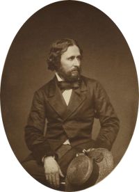
John Charles Frémont,
The Exploring Expedition to the Rocky Mountains…
“ We crossed, at 10 A.M. the Big Vermilion, which has a rich bottom of about one mile in breadth, one-third of which is occupied by timber. Making our usual halt at noon, after a day's march of twenty-four miles, we reached the Big Blue, and encamped on the uplands of the western side, near a small creek, where was a fine large spring of very cold water. This is a clear and handsome stream, about one hundred and twenty feet wide, running with a rapid current, through a well-timbered valley. To-day antelope were seen running over the hills, and at evening Carson brought us a fine deer. ”
1911 Encyclopædia Britannica (1911)
“ S. from the Canadian border is a small area that is drained N. into Lake Memphremagog, the waters of which, like those of Lake Champlain, are tributary to the St Lawrence river. North of Massachusetts the Connecticut river is wholly within New Hampshire—Vermont’s eastern boundary is low-water mark on the W. bank of the Connecticut river. The largest and only navigable rivers of Vermont are among those flowing into Lake Champlain: the Missisquoi, the Lamoille, the Winooski and Otter Creek. The Batten Kill is the principal river flowing into the Hudson. ”
Various, The Rivers of Great Britain, Descriptive…
“ Through rich and peopled meadows finds its way.” At St. Stephen’s-by-Launceston it receives the Werrington stream, and expands into a beautiful lake in Werrington Park. Below the lake the impetuous Attery stream joins the now brimming river, which, passing under Poulston and Greston, reaches Tavistock New Bridge, where we are on the “scientific frontier” of Devon and Cornwall. At this point, too, the Tamar enters upon a new stage of its existence, leaving its lowly moorland birth and quiet ordinary youth behind it, and beginning a career which is henceforth the cynosure of all eyes. ”
Percy Keese Fitzhugh, Tom Slade on the River
“ For about fifteen miles above Port Henry the lake is comparatively narrow, then it opens up to a breadth of ten miles or more, becoming a veritable inland-sea, with the rolling hills of Vermont reaching far eastward and merging in the distance with the lofty Green Mountains. ”
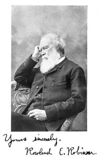
Rowland Evans Robinson,
Vermont: A Study of Independence
“ When returning warm weather set them free, some British gunboats crept up the lake, and on the [Pg 274] 3d of June the Growler and Eagle went in pursuit of them, chasing them into the Richelieu. Having come in sight of the works on Isle aux Noix, the sloops put about and endeavored to make their way back to the open lake against the current of the river and a south wind. Three row-galleys now put out from the fort, and began playing on them with guns of longer range and heavier metal than those of the sloops, upon whom a galling fire of musketry was also rained from the river banks. ”
Hannah Lynch,
Dr. Vermont's fantasy, and other stories
(1896)
“ All was silence and desolation on this side of the island. No one walked its pavements, and the laundresses wheeling their barrows to town from the lower end, instinctively chose the inhabited quarter to pass.‘A man might rot to carrion here,’ said Dr. Vermont, as he stood between the battered walls of the tower, and looked up at the weeping heavens, and then down at the sullen and swollen river. ”
William C. Gage, "Chicago to the Sea." Eastern Excursionist
“ The Green Mountains of Vermont are a portion of the great Appalachian range, extending almost continuously from near the St. Lawrence River, in Canada, through the entire length of Vermont, across the western part of Massachusetts and the middle Atlantic States, to the northern part of Alabama. The White Mountains of New Hampshire, and the Adirondacks and Catskills of New York are regarded as outlying spurs of this chain. ”
The New International Encyclopædia…
“ It lies between latitudes 42° 44′ and 45° 3′ north, longitudes 71° 30′ and 73° 25′ west, and is bounded on the north by the Canadian Province of Quebec, on the east by the State of New Hampshire, on the south by Massachusetts, and on the west by New York. The entire eastern boundary is formed by the Connecticut River, and more than half of the western boundary by Lake Champlain, most of the islands in that lake, including Grand and La Motte islands and the peninsula projecting southward from Canada, belonging to Vermont. ”
Rowland Evans Robinson,
Vermont: A Study of Independence
“ Peace was indeed welcome to a people so long deprived of an accessible market as had been the inhabitants of Vermont.The potash fires were relighted; the lumberman's axe was busy again in the bloodless warfare against the giant pines; new acres of virgin soil were laid bare to the sun, and added to the broadening fields of tilth. White-winged sloops and schooners, and unwieldy rafts, flocked through the reopened gate of the country, and the clumsy Durham boat spread its square sail to the favoring north wind, and once more appeared on the broad lake where it had so long been a stranger. ”
Joseph A. Altsheler,
The Rock of Chickamauga: A Story of the Western Crisis
“ All the pyramids are becoming a little faint as the twilight is advancing. Dick, you call me a cold mathematical person, but this vast river flowing in its deep channel, the dark bluffs up there, and the vast forests would make me feel mighty lonely if you fellows were not here. It's a long way to Vermont. ”
Joel Cook,
America, Volume 4 (of 6)
“ These mountains gave Vermont its name, their highest peaks rising behind Burlington, Mount Mansfield and the Camel's Hump. The New York shore of the lake to the westward presents barren and mountainous scenery, the terminations of the Adirondack ranges being occasionally pushed out as bold promontories to the water's edge, while behind them the higher peaks loom in dark grandeur against the horizon. ”
George Byron Merrick, Old Times on the Upper Mississippi
“ At this point the islands are about four miles across from the main channel of the river; the islands being formed by Vermillion Slough, which heads at Hastings, reëntering the river about two and a half miles above Red Wing. Trudell Slough, which heads in the river about four miles below Prescott, joins Vermillion at the point at which was probably located Le Seuer's post. At the juncture of the two sloughs there was a beautiful little prairie of several acres. On the west, the bluffs rose several hundred feet to the level prairie which constitutes the upper bench. ”
Various, The Catholic World, Vol. 22, October…
“ When he heard that we were from Vermont, he asked for a piece of chalk, and, marking on the floor an outline of the lake and the course of the Richelieu River, he proceeded to narrate the voyage of Champlain and his party in the summer of 1609.Embosomed within the placid waters of Lake Champlain, near its northern extremity, is a lovely island, of which Vermonters boast as the “Gem of the Lake,” so remarkable is it for beauty and fertility. ”
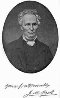
John Mason Peck,
A New Guide for Emigrants to the West
“ Vermillion.—A long, narrow county, between the Wabash river and the State of Illinois. The streams are Wabash, Big and Little Vermillion, and their tributaries. Surface high, rolling land, with abrupt bluffs near the streams; a good proportion of prairie and timber; soil, rich, sandy loam, and very productive. Minerals; freestone and limestone, and large coal banks.Vigo.—The Wabash passes through it—navigable. The mill streams are Prairie, Honey, Otter, and Sugar creeks, but their waters fail in a dry season. Surface level, or gently undulating, with forest and prairies ”
Grove Karl Gilbert,
Report on the geology of the Henry Mountains
(1877)
“ The revet-crags of Vermilion sandstone follow, in a general way, the line of maximum dip about the base of Mount Ellsworth; but a few of them rise higher, and one—that which joins the northwest spur—climbs until it is but little lower than the summit of the mountain. Outside the circle of Vermilion Cliff sandstone lies the Gray Cliff sandstone, and in a few places it takes the form of a revetment. Inside the same circle there are many revetments, constituted by trachyte sheets bedded in Shinarump shales (Figure 14) . ”